Print Back to top
Featured Photo

Exploring the Colorado River and Lake Powell

Photo journal gives a firsthand look at the river and lake and shares Denver Water’s connection to the important waterway and reservoir.

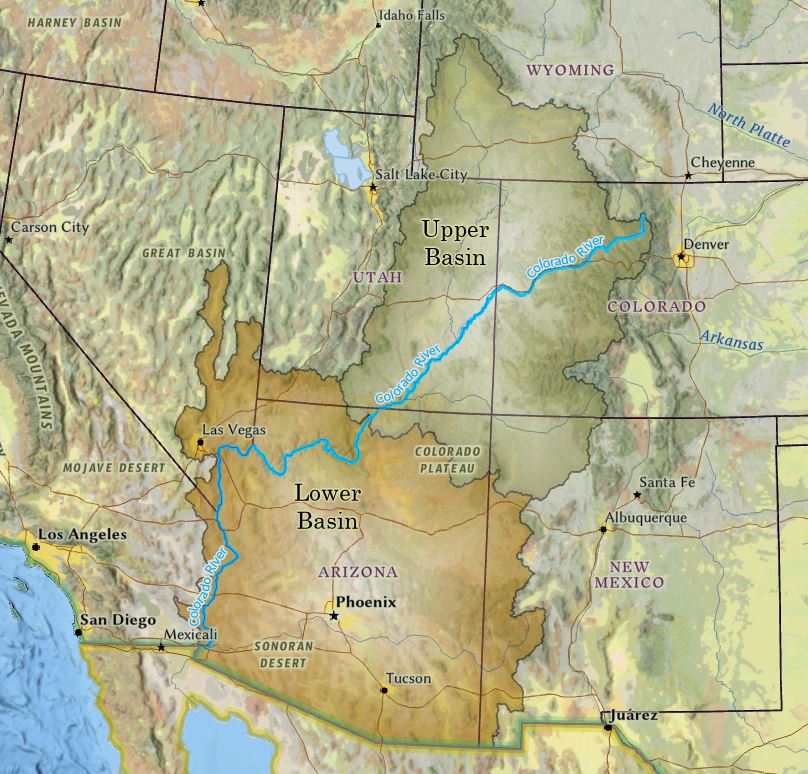
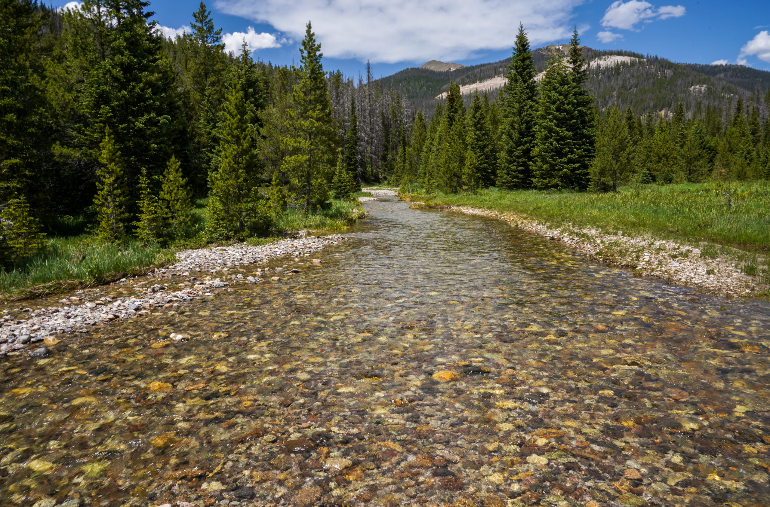
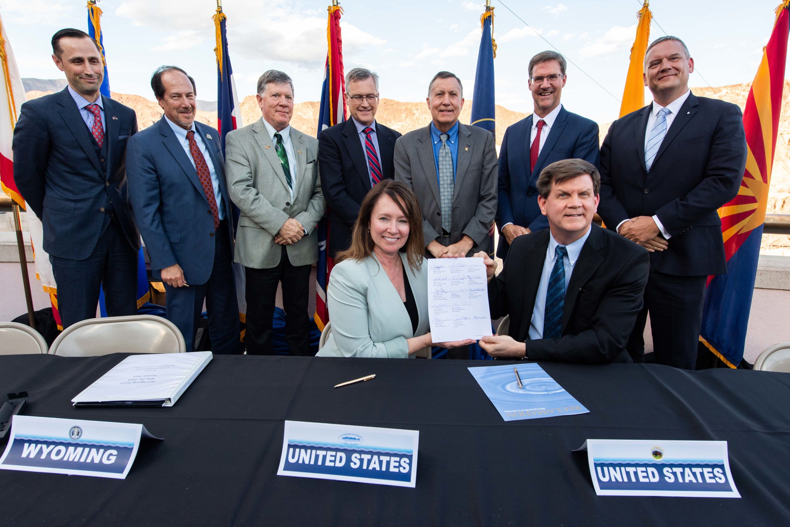
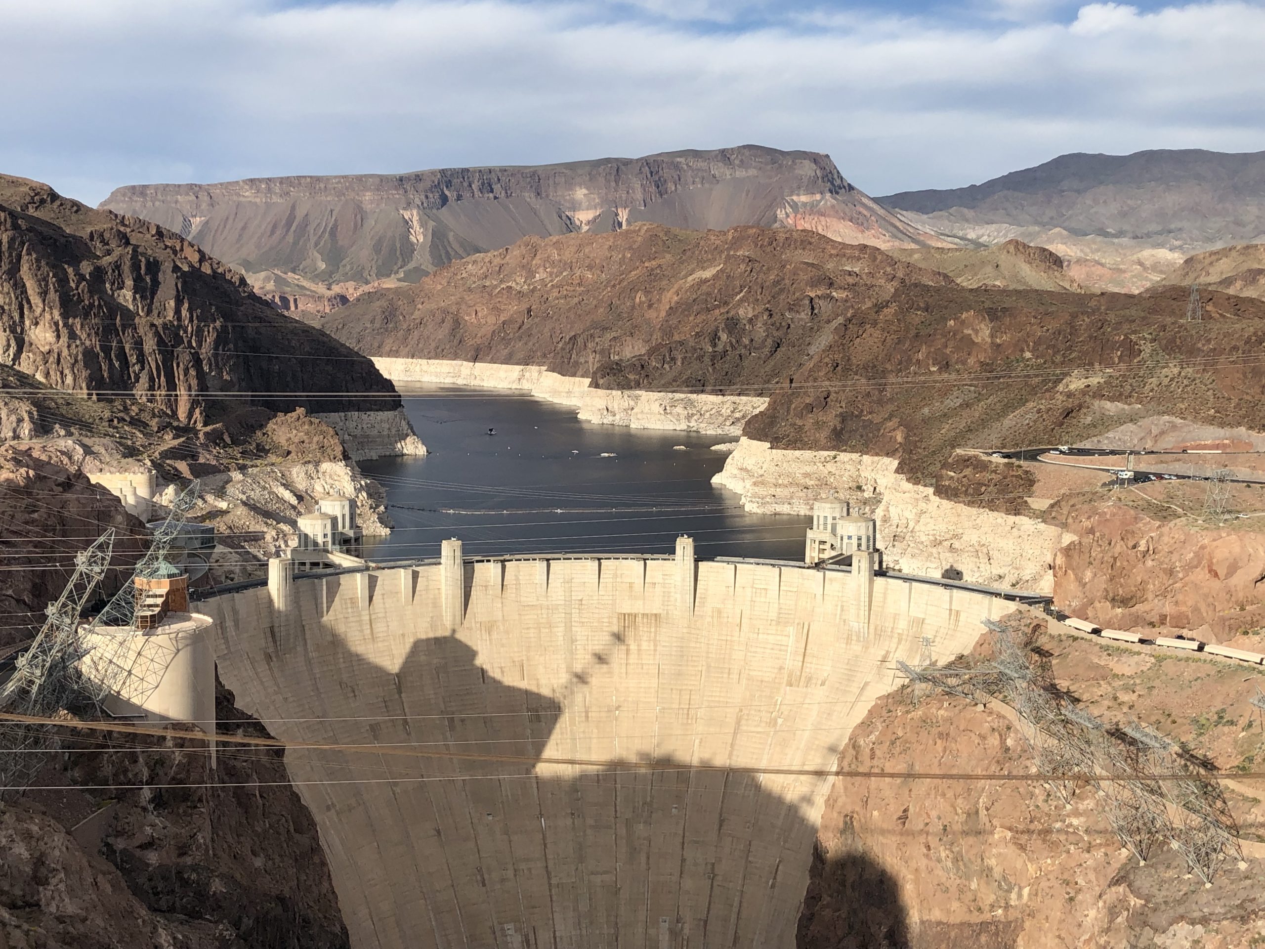
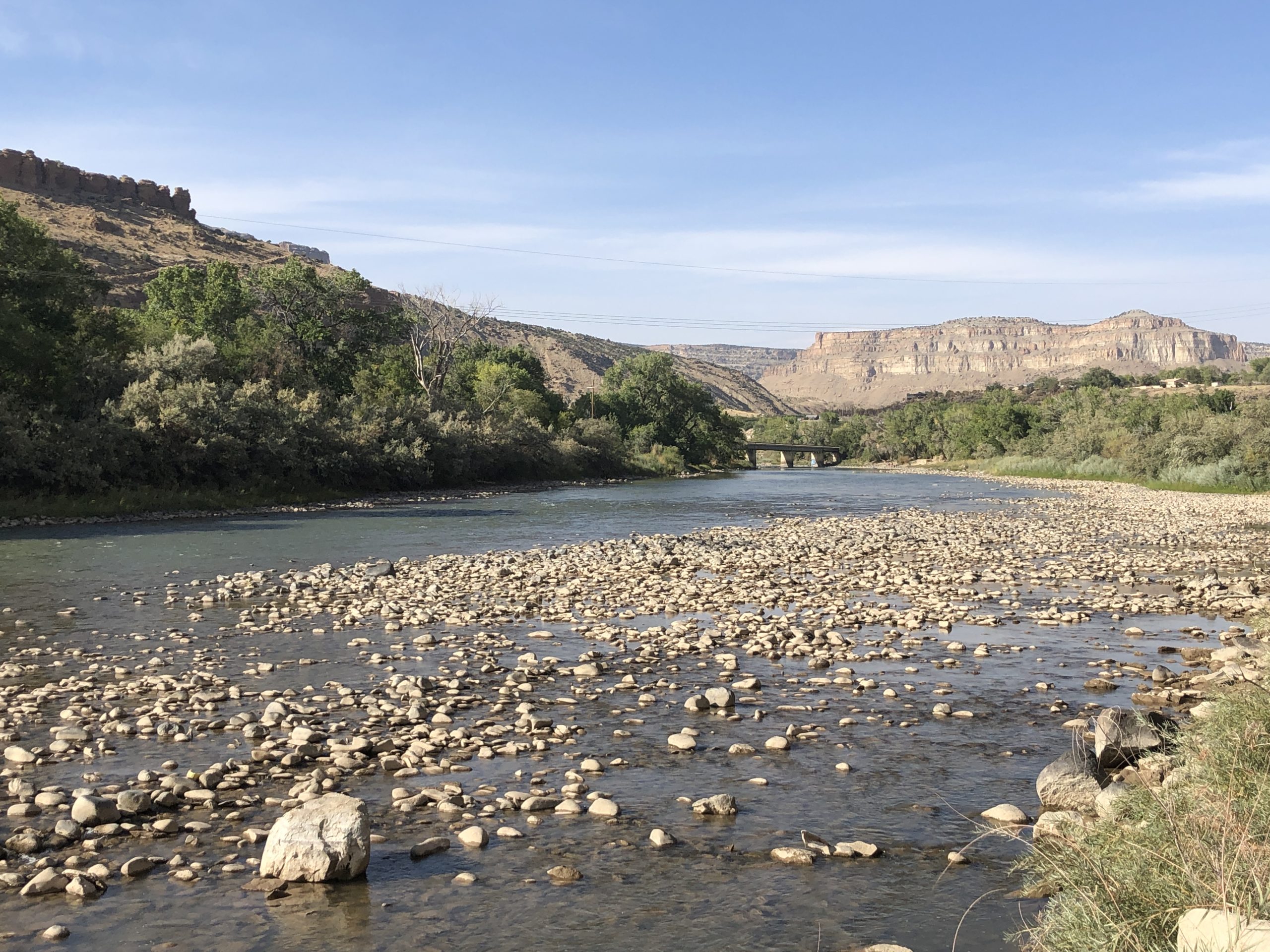
Over the years, I’ve written and researched many water topics that impact Denver Water and our customers. During this time, I’ve traveled to the headwaters of the Colorado River, learned about the river’s tributaries, paddled through canyons in western Colorado and ventured to Lake Mead.

But I’d never been to Lake Powell.

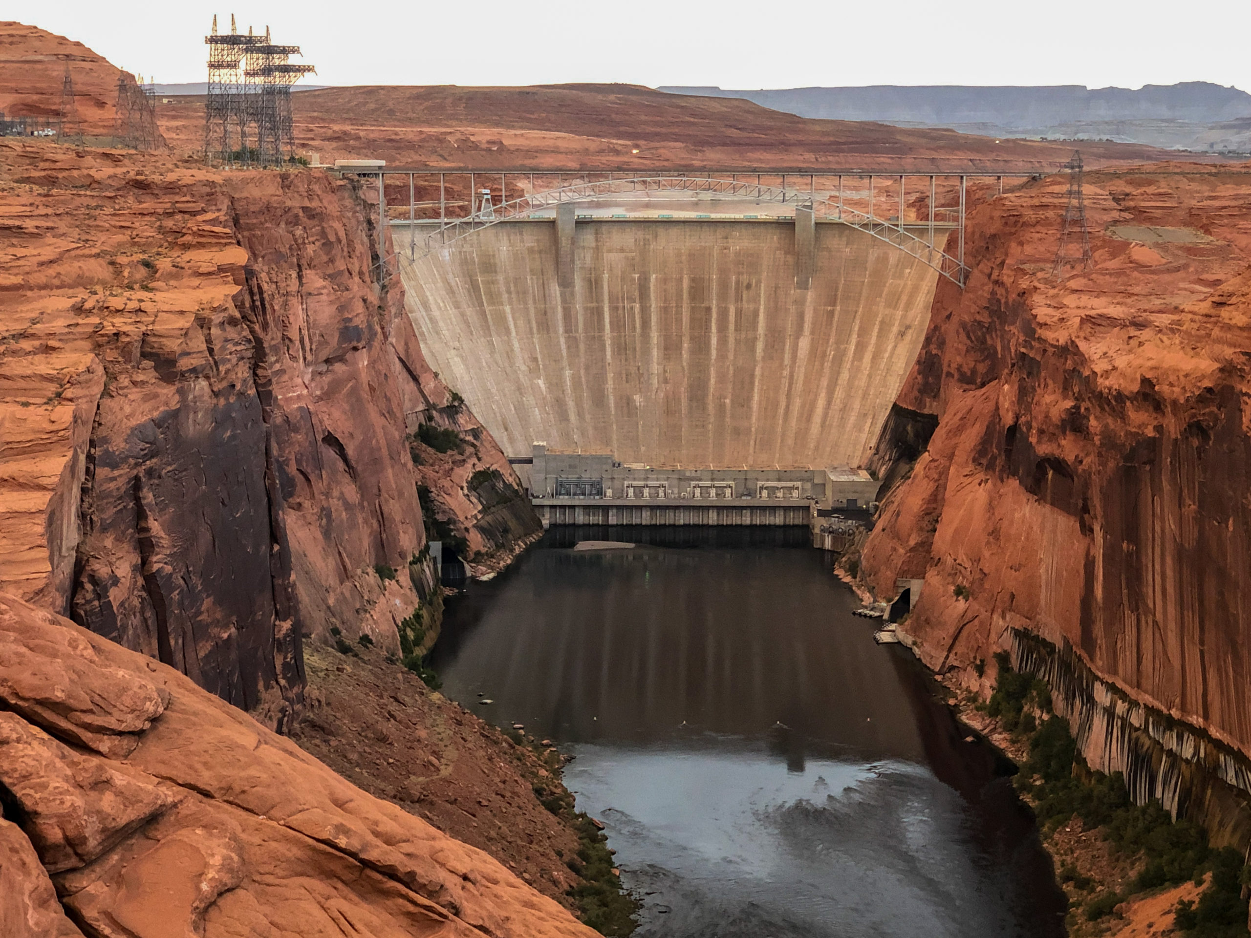
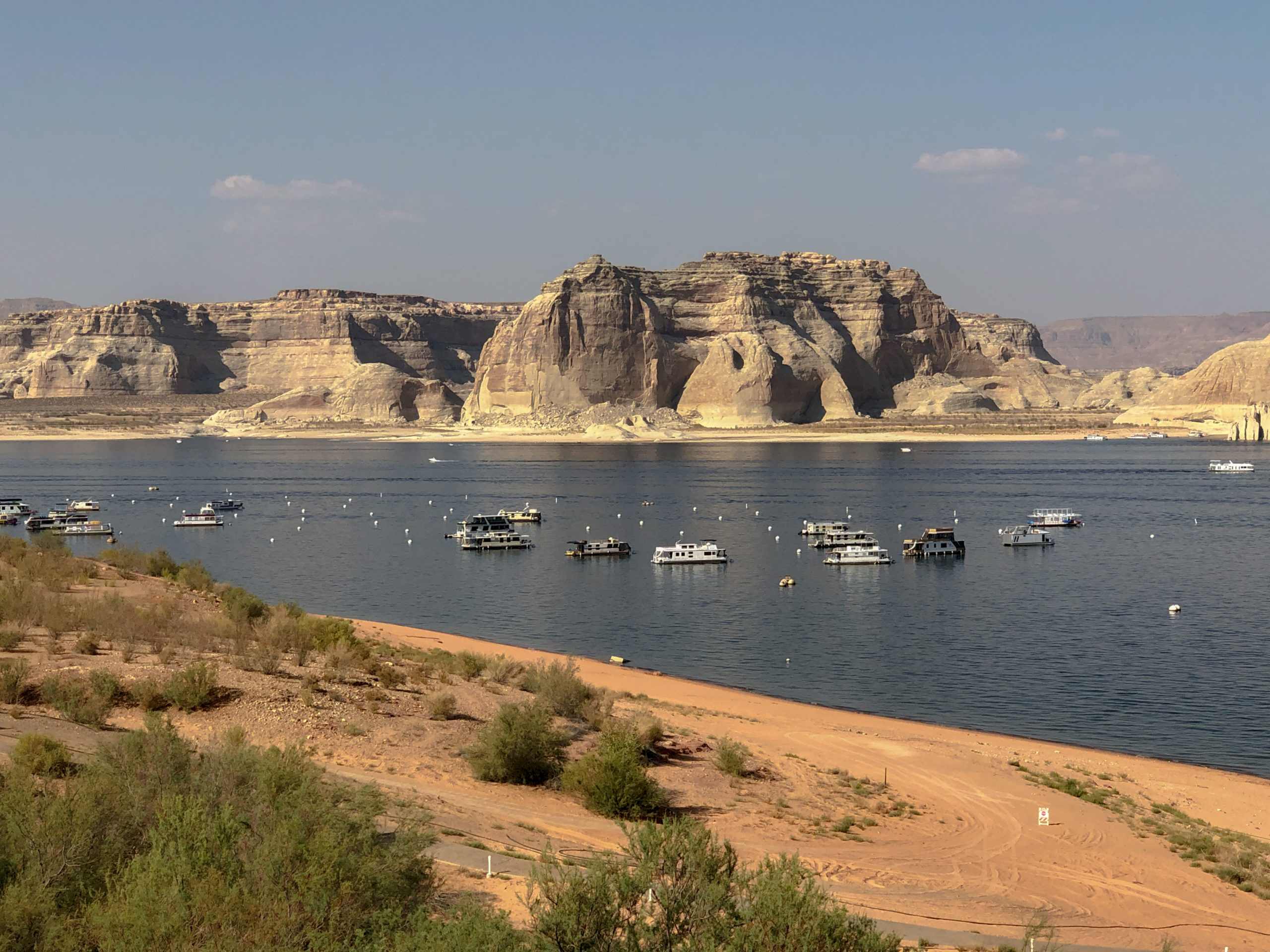
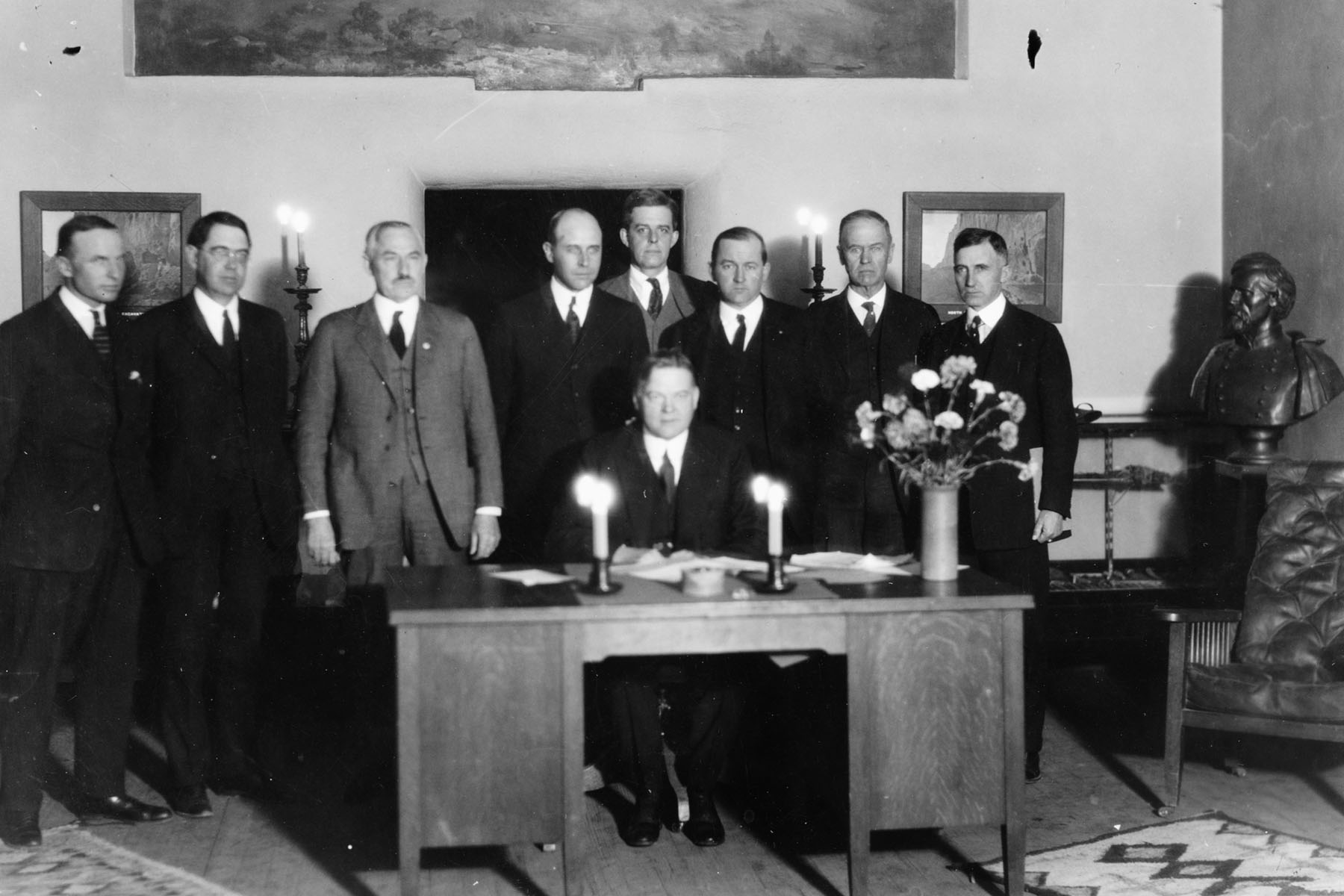
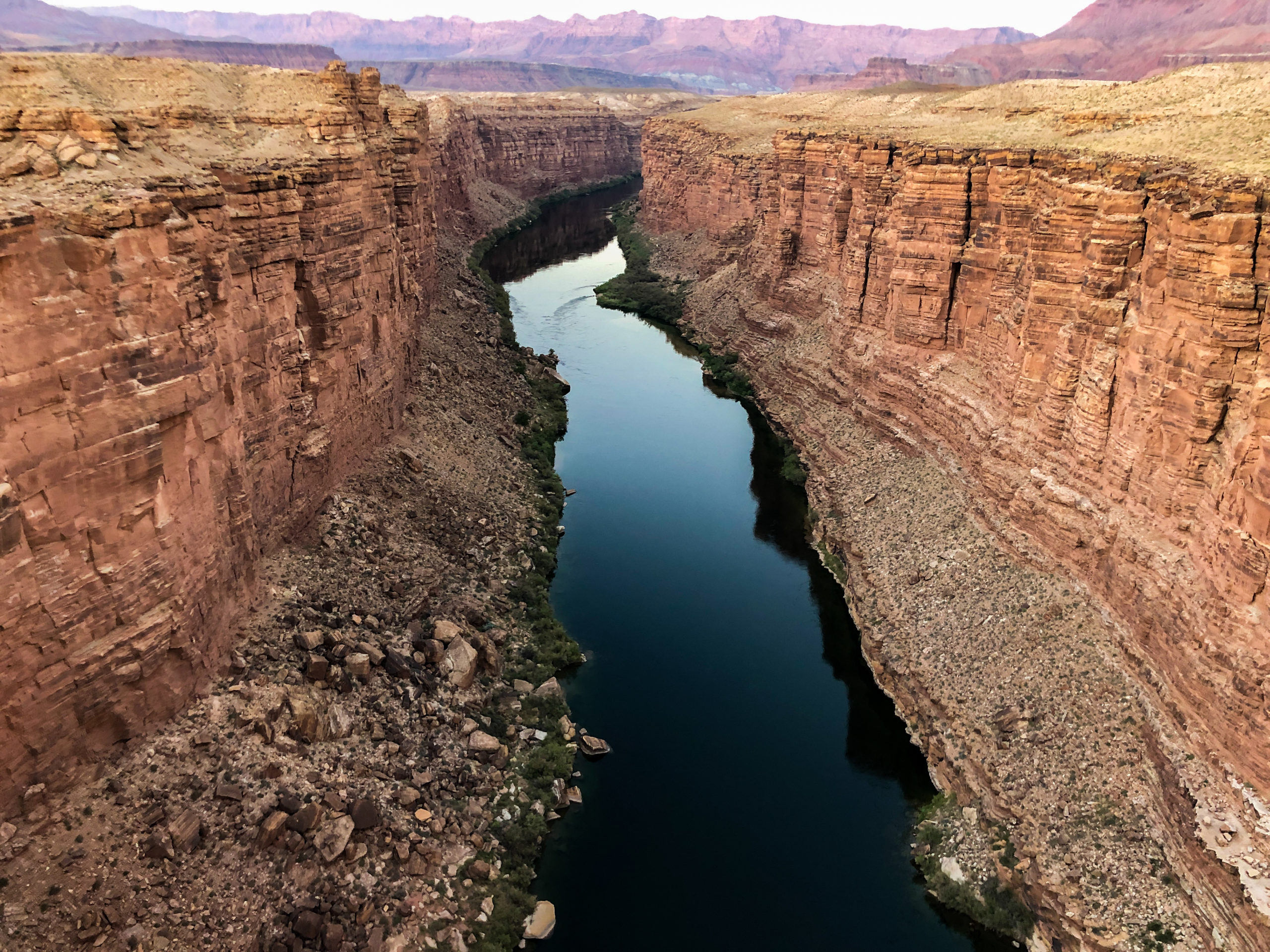
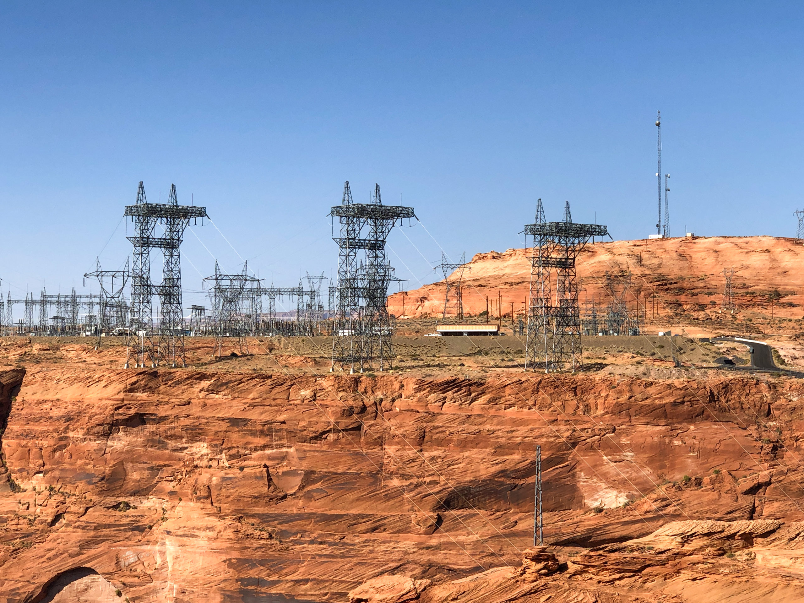
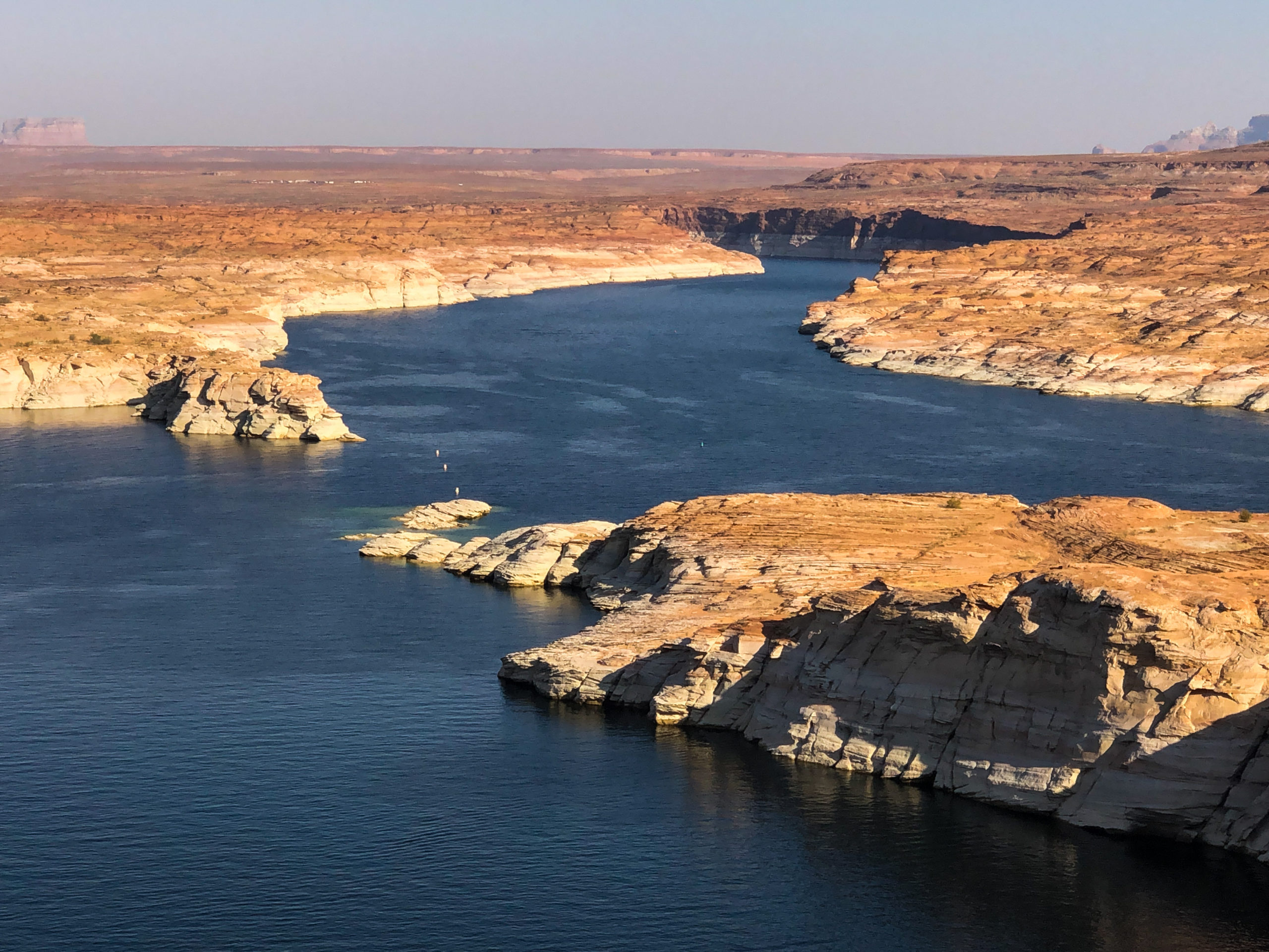
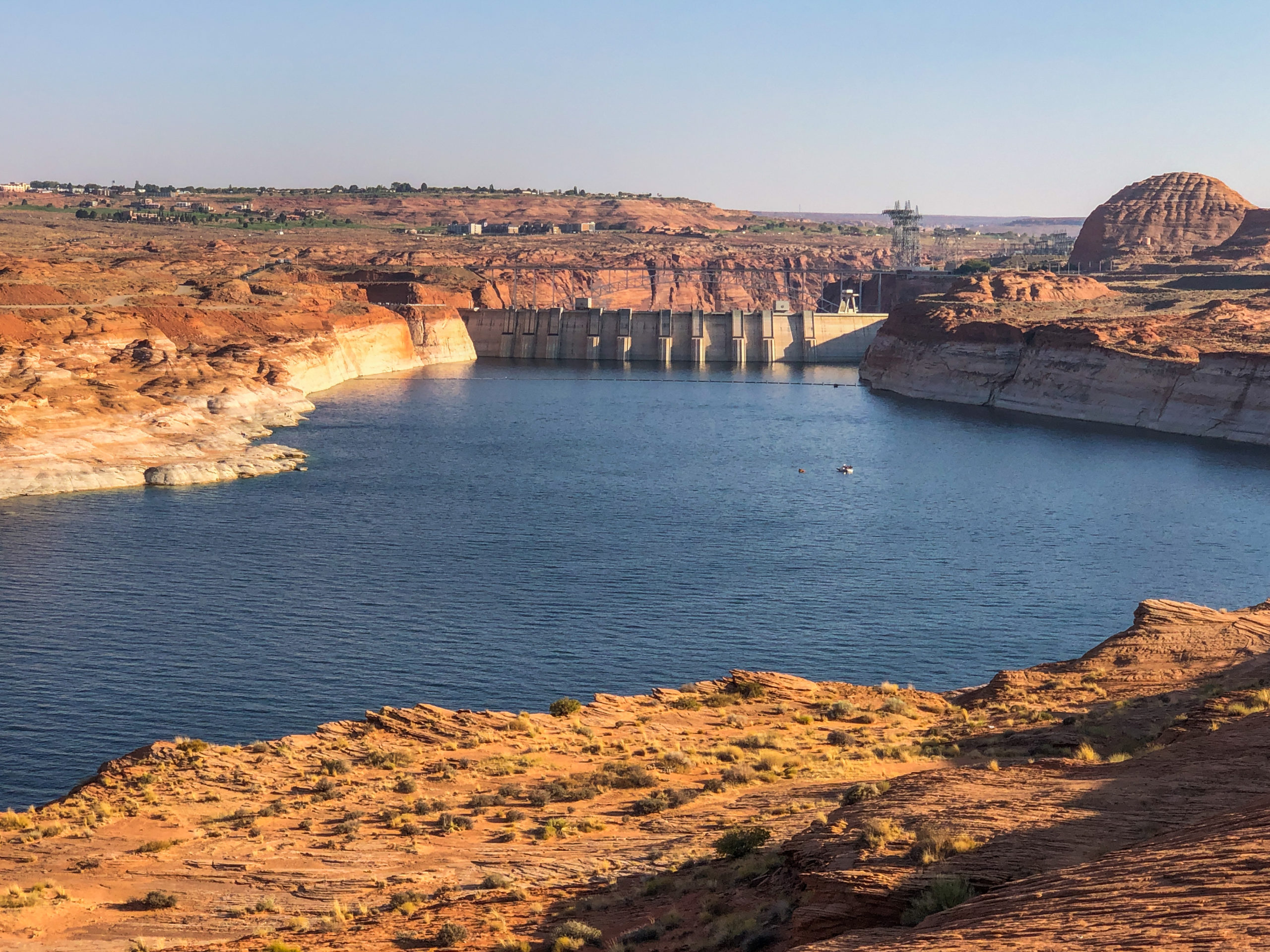
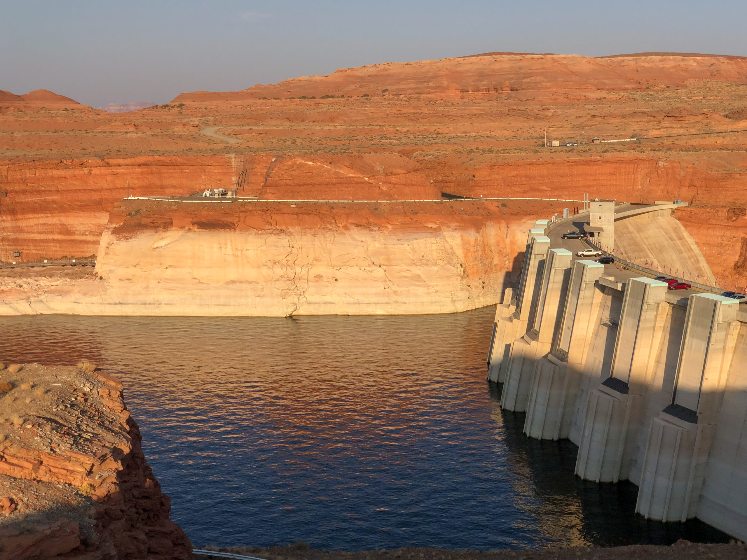
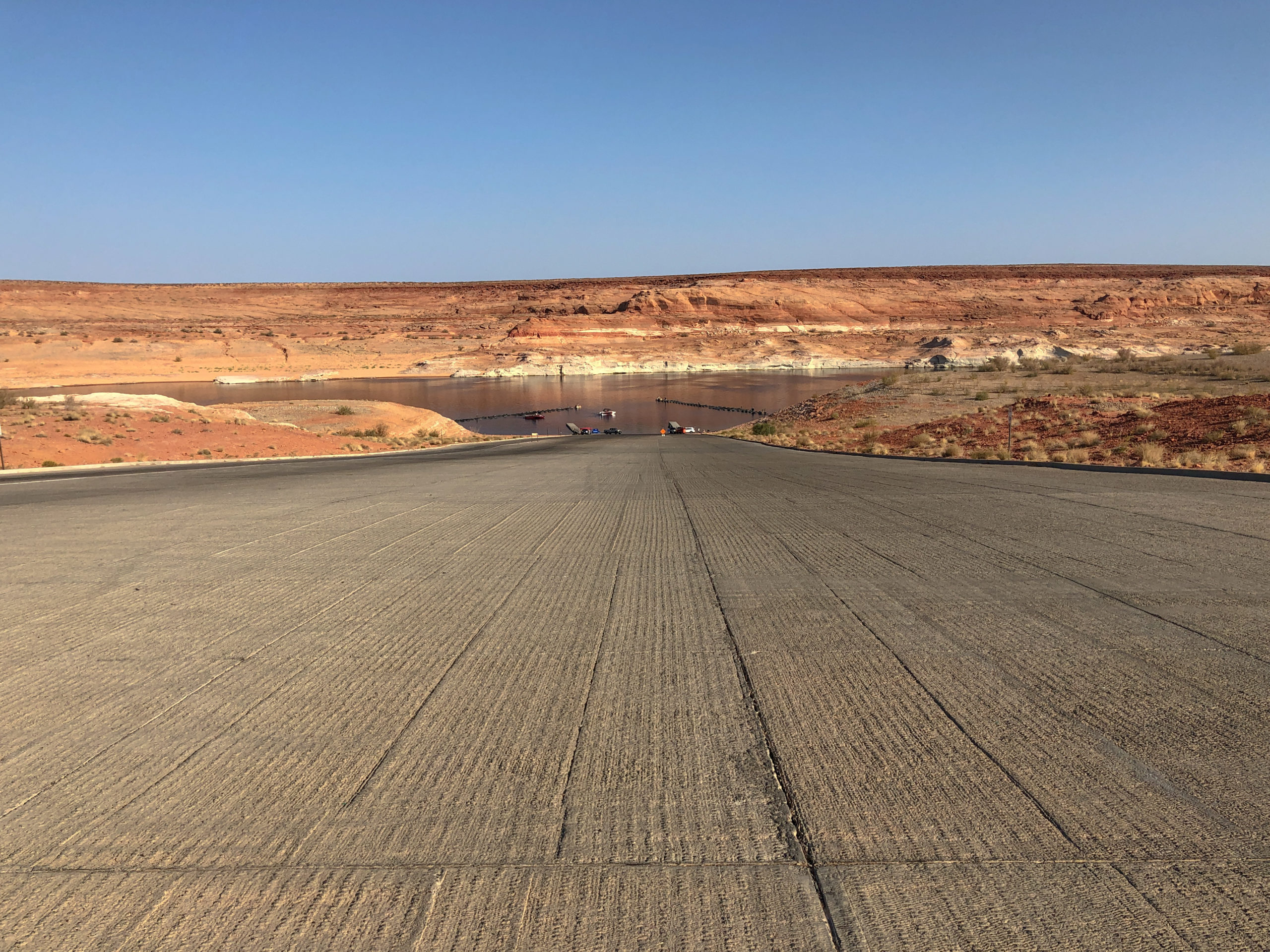
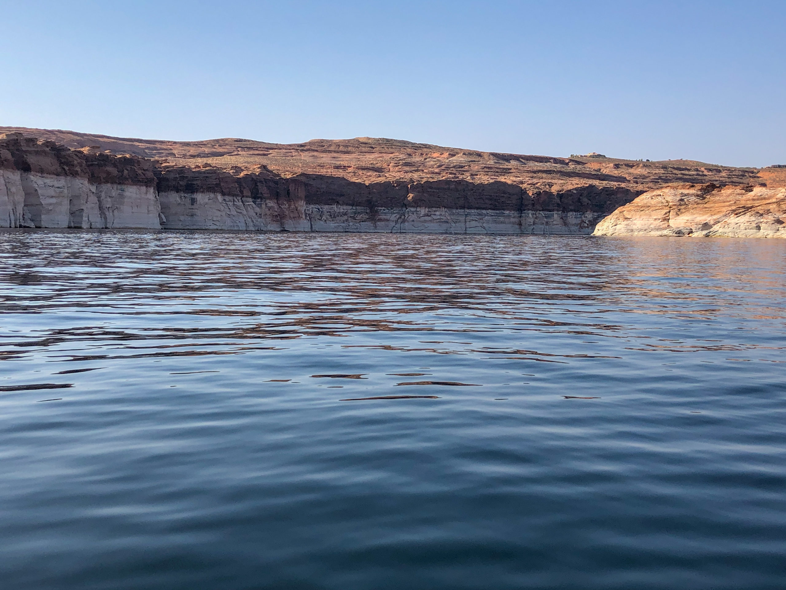
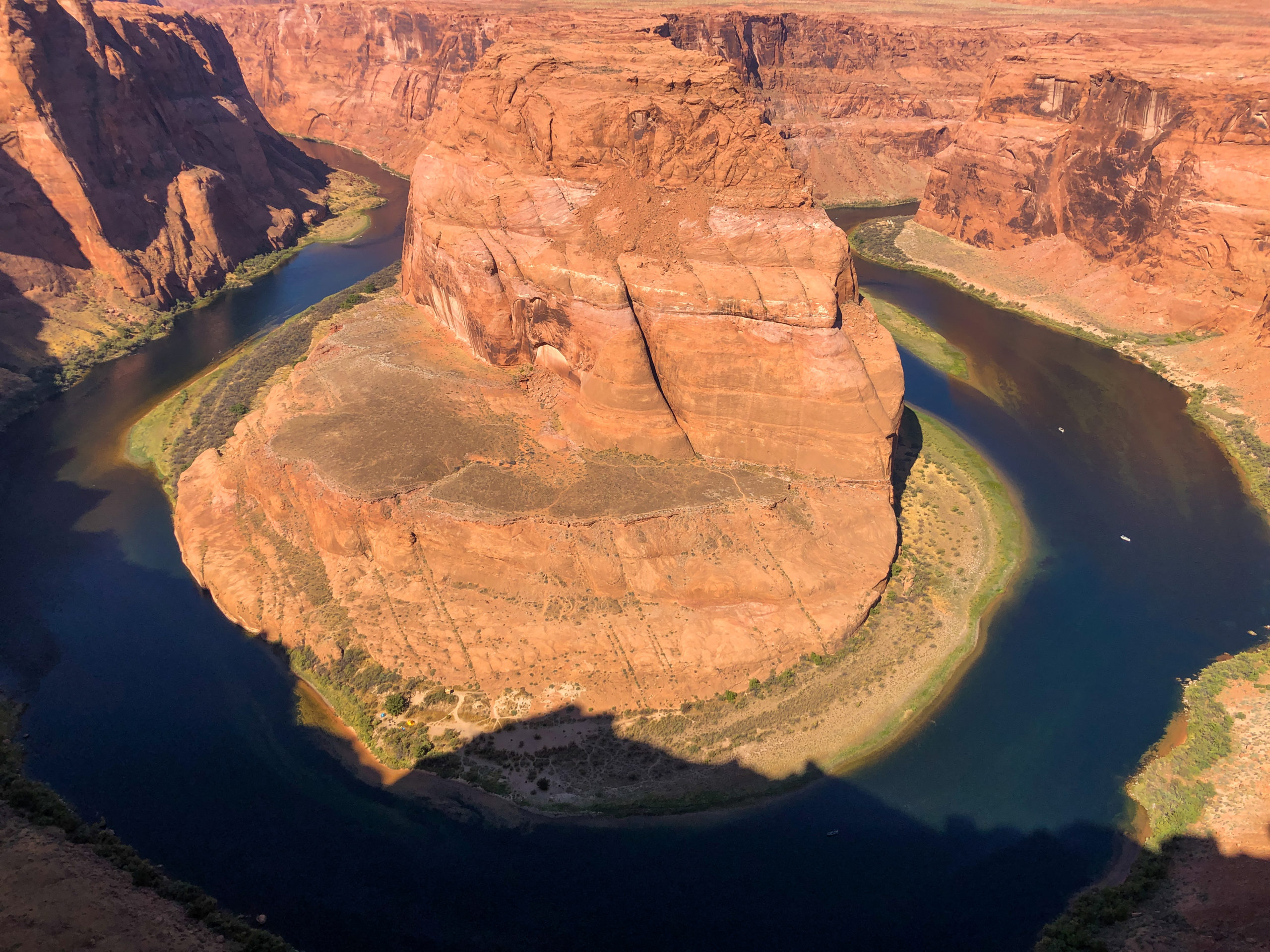
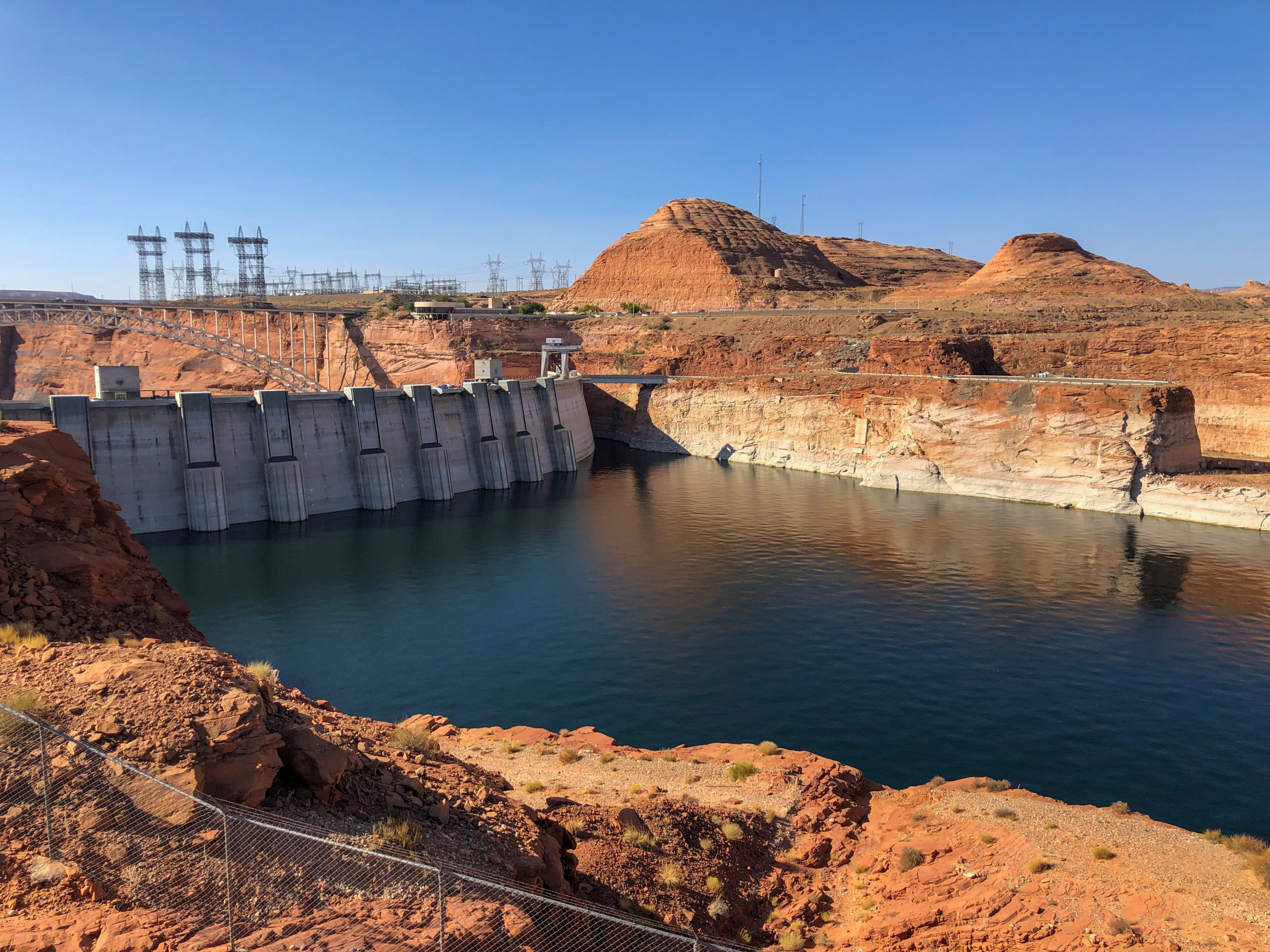
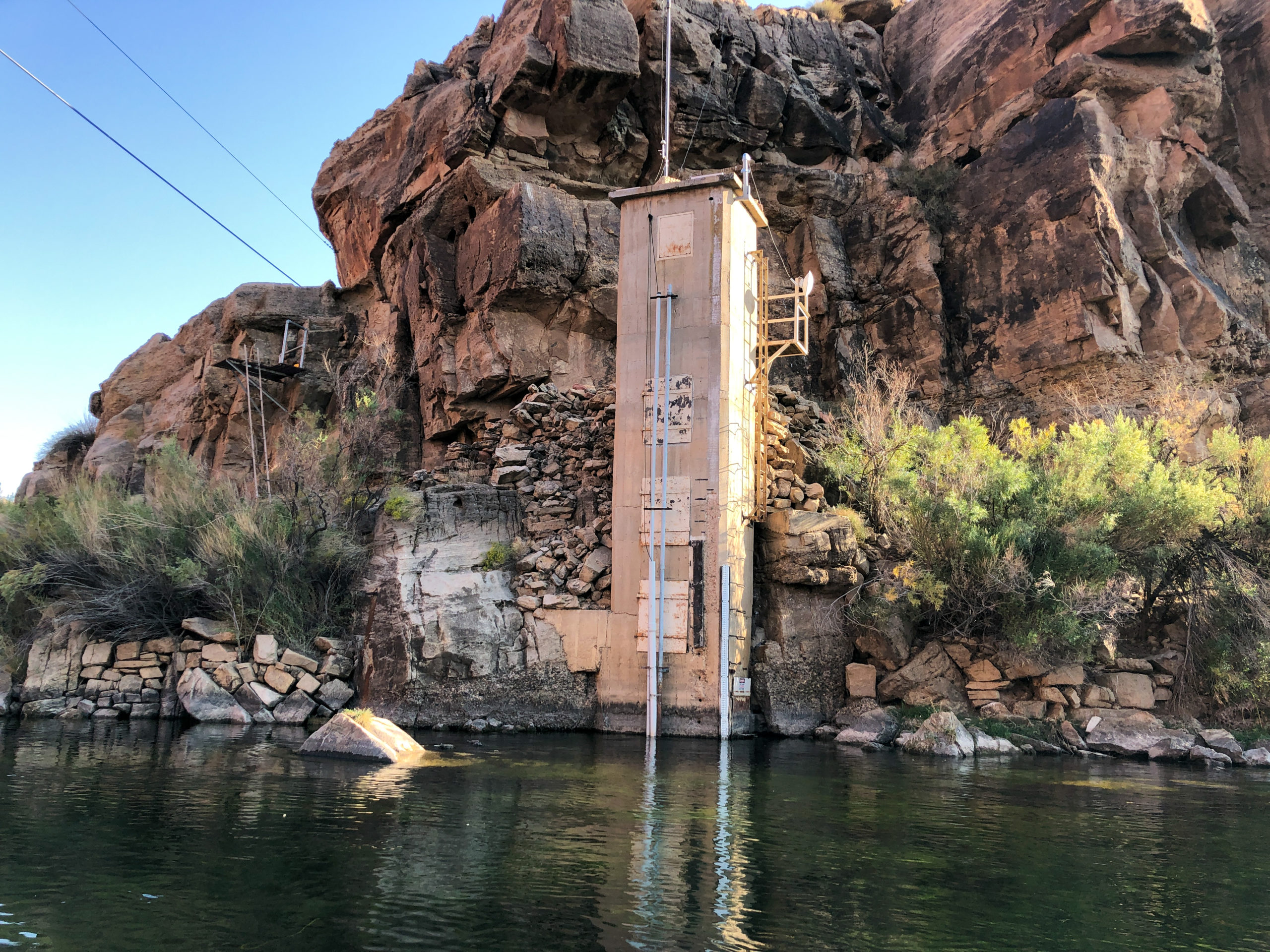
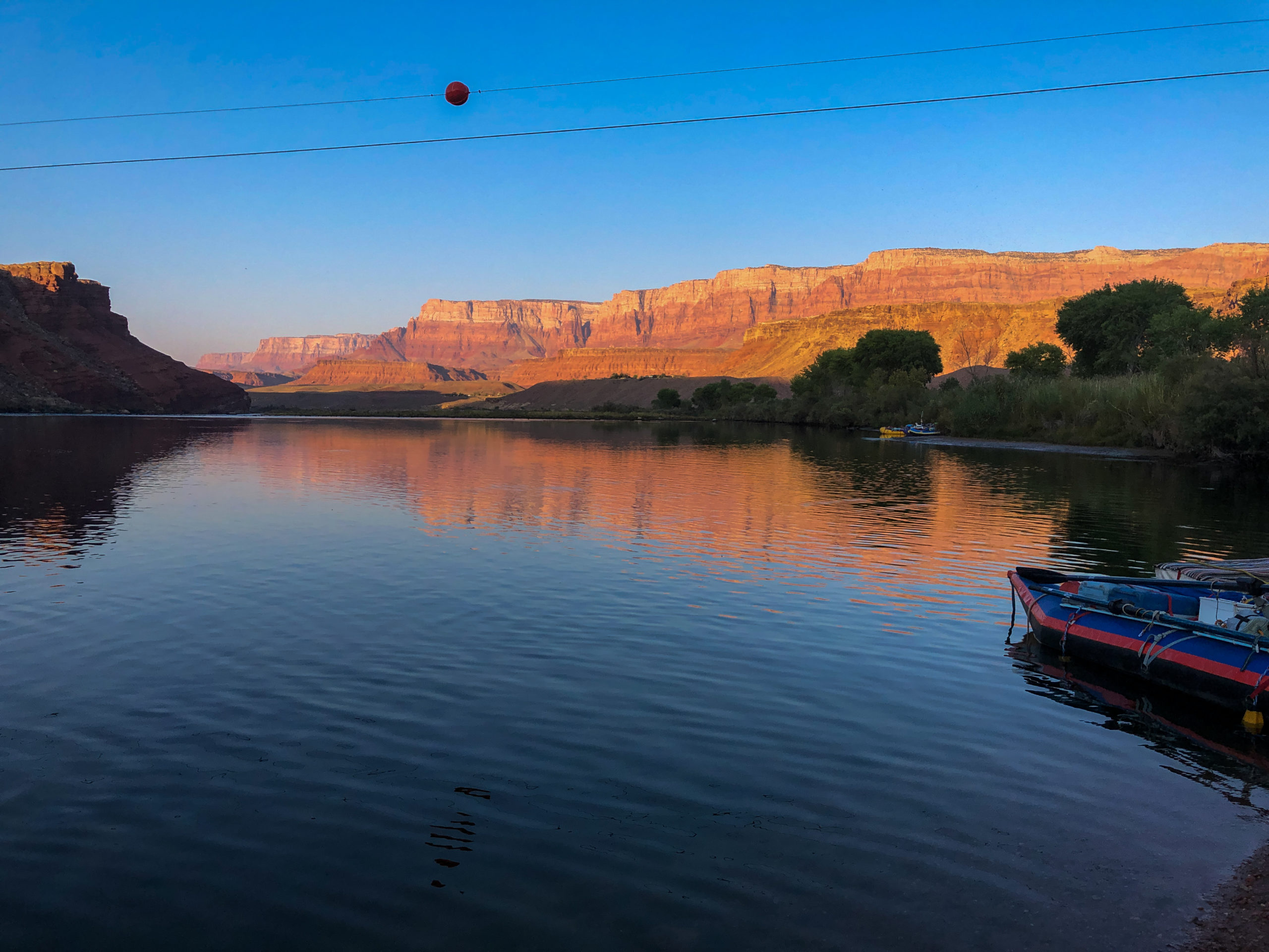
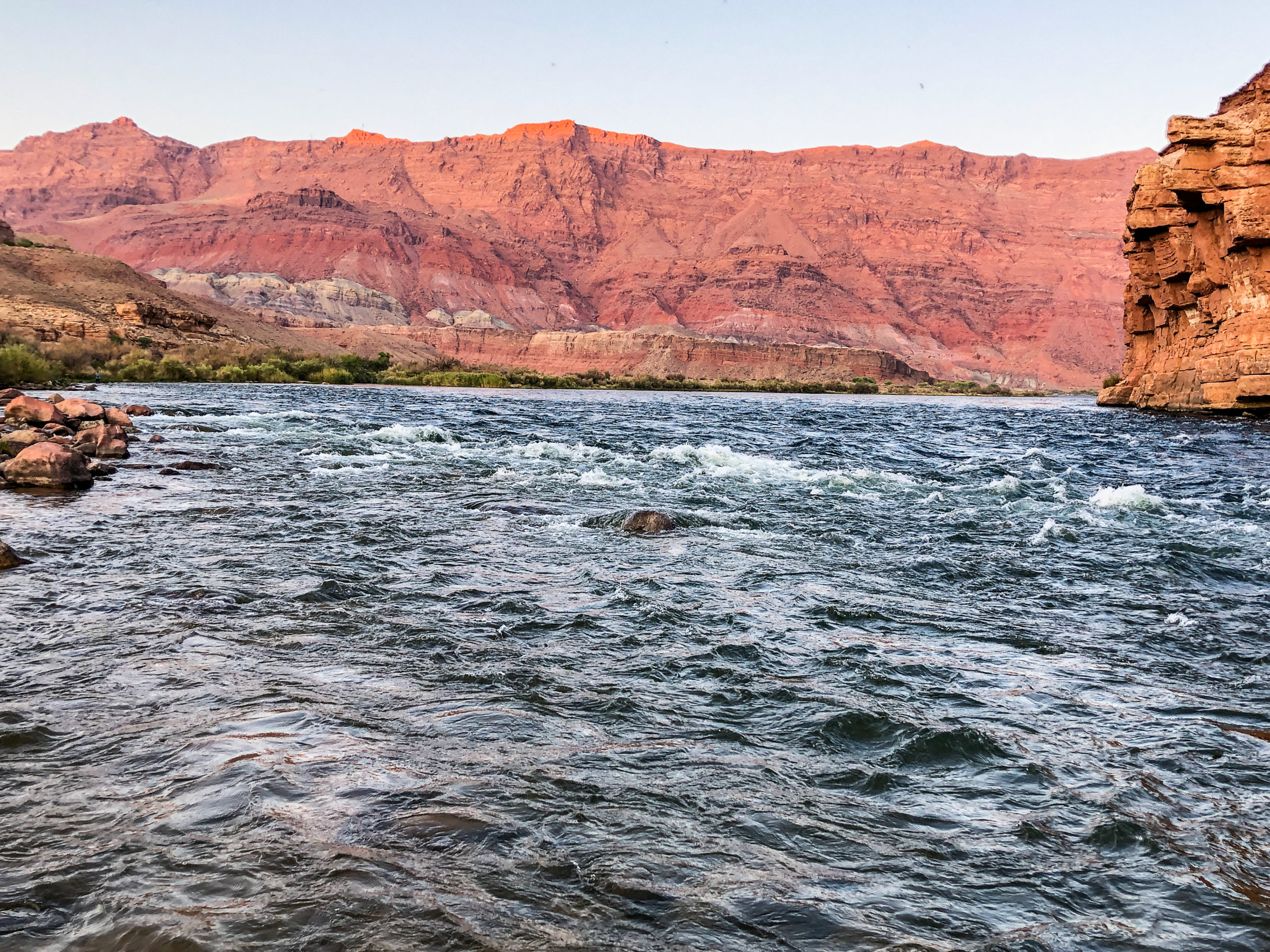
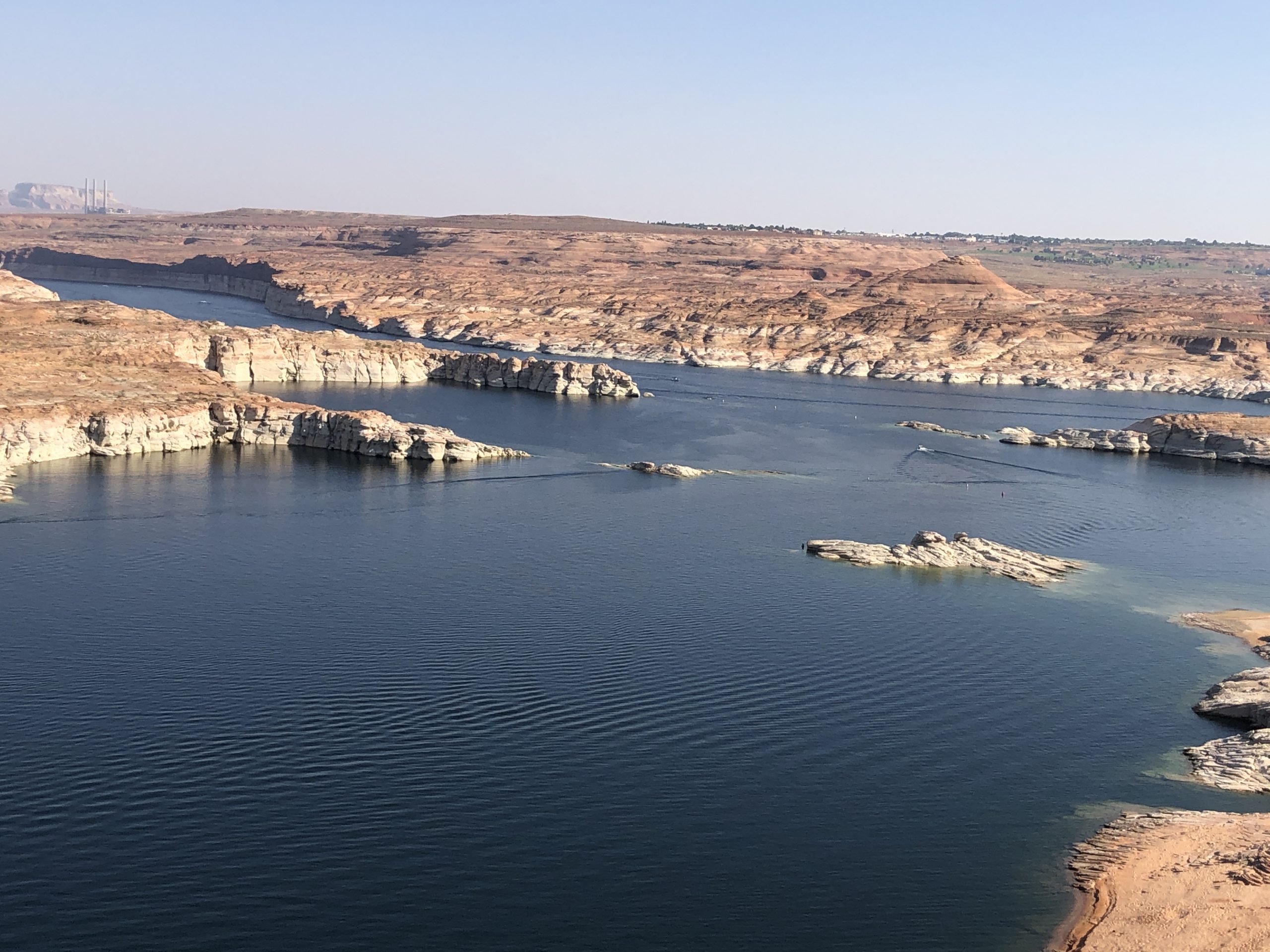
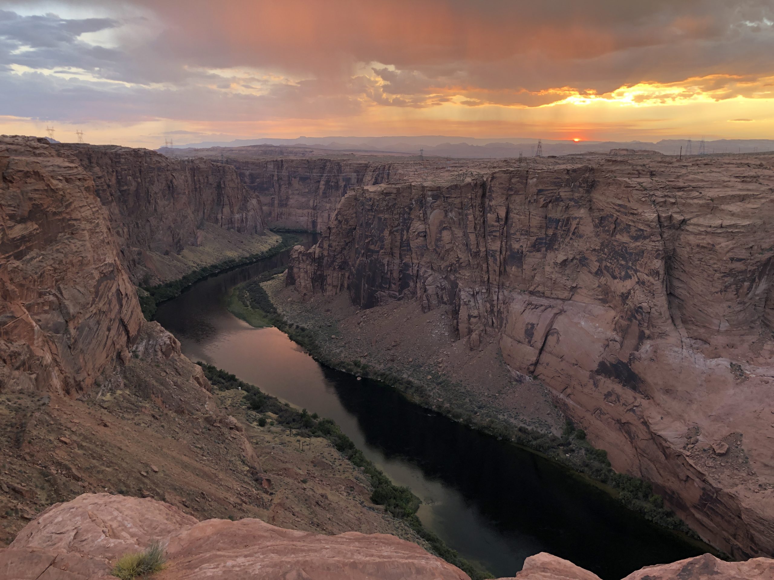
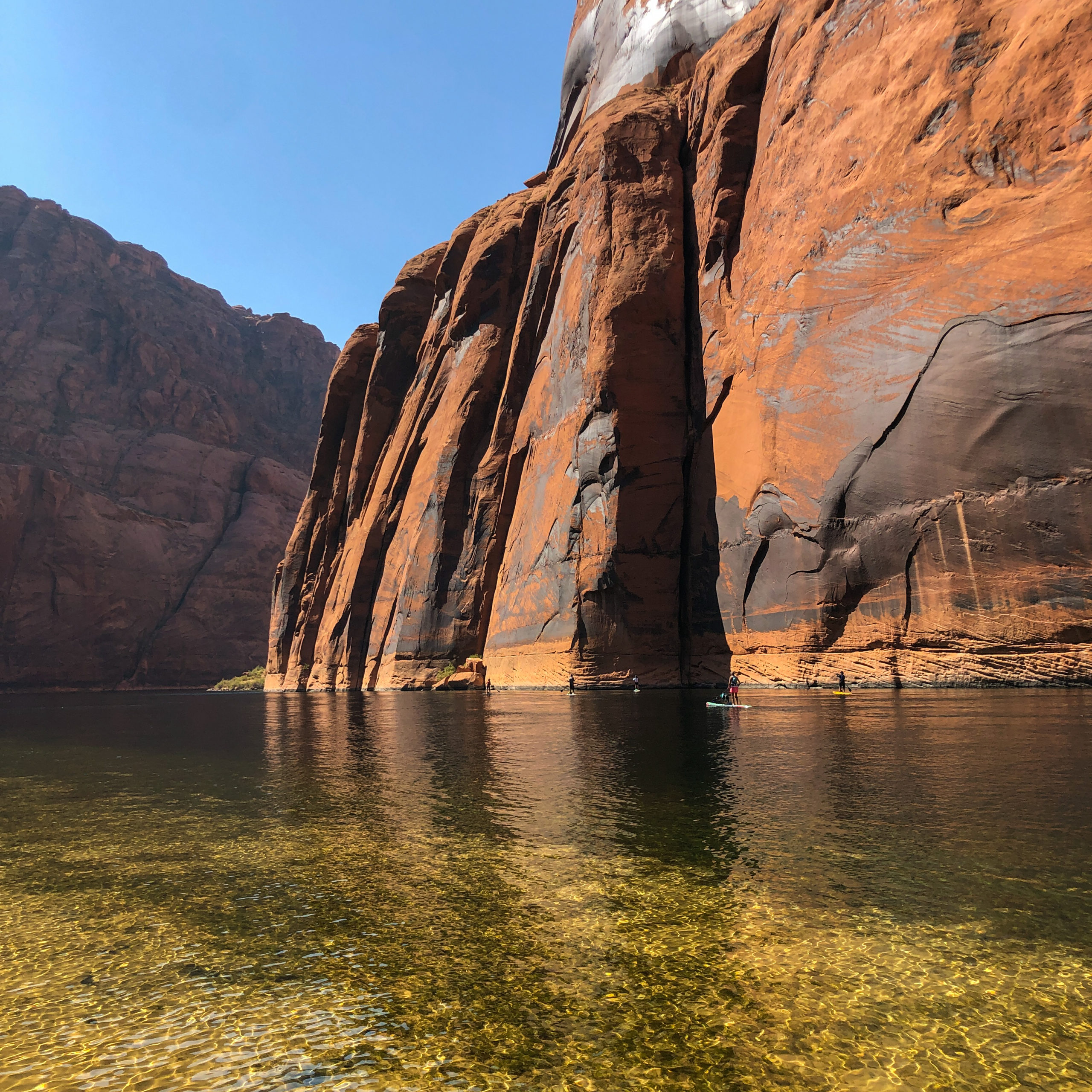
The pictures that follow were taken during a visit to Lake Powell’s southern end near Page, Arizona, from Sept. 21-25. There are some added photos from past stories and from additional resources.

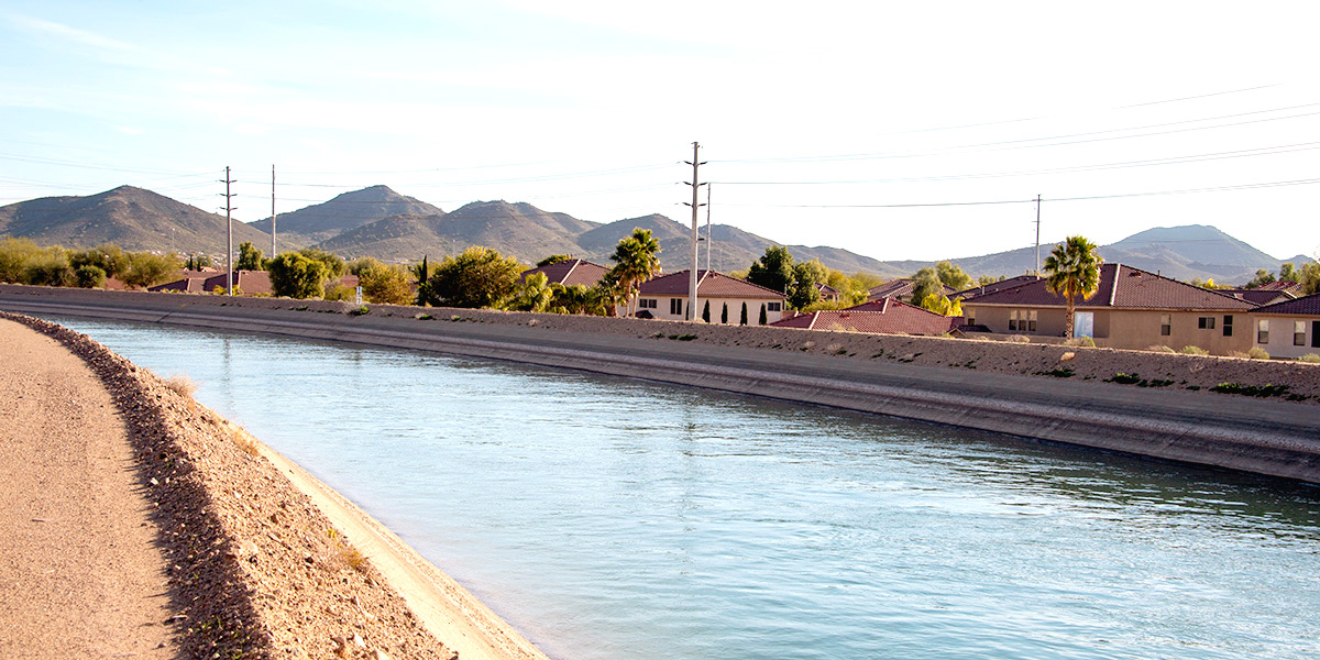
While water use is often taken for granted, I hope these pictures and information will help give you a basic understanding of the connection between Denver Water, the Colorado River, Lake Powell and our water supply here in the Front Range.


Glen Canyon Dam in Page, Arizona, was completed in 1963 and created Lake Powell along the Colorado River. The dam is managed by the U.S. Bureau of Reclamation. The dam is 710 feet high and is the second-tallest concrete-arch dam in the U.S., second to Hoover Dam near Las Vegas. Photo credit: Denver Water.


While Lake Powell is known for its recreation, its primary purpose is to store water for Colorado, New Mexico, Wyoming and Utah in wet years for downstream water supply obligations in dry years under the 1922 Colorado River Compact. Photo credit: Denver Water.


President Herbert Hoover and representatives from seven western states sign the Colorado River Compact in 1922 near Santa Fe, New Mexico. The Compact allocated the amount of Colorado River water that Arizona, California, Colorado, Nevada, New Mexico, Utah and Wyoming could legally use for water supply. Photo credit: U.S. Department of Interior, Bureau of Reclamation.


This map shows the Colorado River Basin and the seven states connected to the river and its tributaries. The Upper Basin includes Colorado, New Mexico, Utah and Wyoming and a small part of Arizona. The Lower Basin includes Arizona, California, Nevada and small portions of New Mexico and Utah. The Compact states that water from the Colorado River is to be shared equally between the two basins.


The Colorado River, which feeds into Lake Powell, begins its 1,450-mile journey in Rocky Mountain National Park near Grand Lake, Colorado. Denver Water gets half of its water from tributaries that feed into the Colorado River. These tributaries include the Fraser River in Grand County and the Blue River in Summit County. Photo credit: Denver Water.


A tranquil stretch of the Colorado River near the Navajo Bridge in Marble Canyon, Arizona. The river supplies water to 40 million people across seven western states and is used to irrigate 5.5 million acres of land for agricultural uses. Photo credit: Denver Water.


The hydropower plant at Glen Canyon Dam can generate 1,320 megawatts of electricity that is distributed to people in Arizona, Colorado, Nebraska, Nevada, New Mexico, Utah and Wyoming. Photo credit: Denver Water.


Lake Powell ended the 2020 “water year” at an elevation of 3,596 feet above sea level. That is 104 feet below what is considered Powell’s full capacity. “Water year” is a term used by the U.S. Geological Survey to measure the 12-month hydrologic cycle between Oct. 1 and Sept. 30. The October start date is used to mark when snow begins to accumulate in the mountains. Photo credit: Denver Water.


Glen Canyon Dam with the town of Page, Arizona, in the upper left. Lake Powell was at 46% of capacity on Sept. 30 after dropping 19 feet during the previous 12 months. The last time the lake was full was in 1987, but the reservoir levels remained at near-full capacity through the late 1990s. Photo credit: Denver Water.


This picture of Glen Canyon Dam from Sept. 23 shows the “bathtub ring” around Lake Powell’s sandstone canyon walls. The ring was created by mineral deposits when the lake level was at higher elevations. The distinct line in the rock is a clear reminder of how far water levels have fallen since 2000. Photo credit: Denver Water.


The large boat ramp at Antelope Point near Page, Arizona, provides another glimpse of what Lake Powell looks like when the water level is down 104 feet. As water levels drop, some boat ramps around the lake can no longer be used. Photo credit: Denver Water.


Lake Powell’s shoreline near Antelope Canyon in Page, Arizona. Lake Powell’s water level goes up during the annual snow runoff from May through July and then goes down the rest of the year. Powel’s overall level is dropping because more Colorado River water is being used for water supply and irrigation than is coming in from the mountains. Photo credit: Denver Water.


The Colorado River at Horseshoe Bend about 7 miles downstream of Lake Powell. The period between 2000 and 2019 marked the driest 20-year stretch in the Upper Colorado River Basin since Lake Powell opened. There were only four years in that timeframe during which there were above-average inflows into Lake Powell. Warming temperatures due to climate change have had a significant impact on reducing water flows on the Colorado River. Photo credit: Denver Water.


In 2020, snowpack in the region that supplies water to Lake Powell was about average. However, the amount of water that flowed into Lake Powell was only 55% of normal. Above-average temperatures in late spring and early summer combined with below-average precipitation helped contribute to the low flows into the reservoir. Photo credit: Denver Water.


This is the Lees Ferry gauging station located on the Colorado River 15 miles downstream from Glen Canyon Dam. The gauge is used to measure the amount of water flowing down the Colorado River from the Upper Basin to the Lower Basin. Photo credit: Denver Water.


Looking downstream from Lees Ferry, Arizona, on Sept. 24. The location is the only place for hundreds of miles with easy access to the Colorado River. John Doyle Lee, for whom the location is named, used a ferry to shuttle settlers heading from Utah to Arizona across the river in the 1870s. The site is now used as a launching spot for rafters who plan to voyage through the Grand Canyon. Photo credit: Denver Water.


The Colorado River at the confluence with the Paria River. This spot marks the boundary between the Upper and Lower Colorado River basins. Water from this point flows through the Grand Canyon and on to Lake Mead. Photo credit: Denver Water.


In May 2019, Colorado joined six other western states and the U.S. Bureau of Reclamation to sign a Drought Contingency Plan to find temporary solutions to the Colorado River’s supply and demand imbalance. Photo credit: U.S. Bureau of Reclamation, May 20, 2019.


A canal carries Colorado River water to communities in Arizona. As part of the 2019 Drought Contingency Plan, Arizona and Nevada reduced water diversions from the Colorado River in 2020 to help keep more water in Lake Mead. Photo credit: Central Arizona Project.


Hoover Dam and Lake Mead, near Las Vegas in April 2019. Lake Mead serves as a “bank account” for Arizona, California and Nevada to store Colorado River water. Lakes Mead and Powell are the first and second largest reservoirs in the U.S. respectively. They are managed by the U.S. Bureau of Reclamation. Photo credit: Denver Water.


Lake Powell as viewed from the southwestern shore near Wahweap Bay. Colorado, New Mexico, Utah and Wyoming are looking at the feasibility of programs that manage water use as part of the Drought Contingency Plan to boost water supplies in Lake Powell. Photo credit: Denver Water.


Low water levels along the Colorado River in Palisade, Colorado, on Sept. 25. If implemented, demand management programs would involve having farmers, ranchers, industries and cities voluntarily and temporarily reduce how much water they deplete from the Upper Colorado River Basin. The water left in the river would be stored in Lake Powell to create a water savings “bank account” that would be used in dry years to meet Colorado River Compact obligations. Photo credit: Denver Water.


The Colorado River at sunset below Glen Canyon Dam on Sept. 21. The seven western states linked to the Colorado River and the U.S. Department of Reclamation are working on revisions to the 2007 Interim Guidelines that were put in place to preserve and balance water in lakes Powell and Mead. The new plan is scheduled to be implemented Jan. 1, 2026. Photo credit: Denver Water.


Paddleboarders experience the incredible scenery of the Colorado River below Glen Canyon Dam. The river faces many challenges in the future, with climate change and population growth putting added pressure on river habitat and water supply. Changes in climate in the Upper Colorado River Basin and river management will have impacts on Denver Water customers in the future. Photo credit: Denver Water.


Look for more information about the Colorado River from Denver Water CEO/Manager Jim Lochhead and in this video series. We also have stories about Confronting Colorado River Challenges, and how Denver Water works to improve endangered fish habitat on the Colorado River.