Video
Uncovering Dillon's underwater footprint
Scans by survey team detail the bottom of Denver Water's largest reservoir.
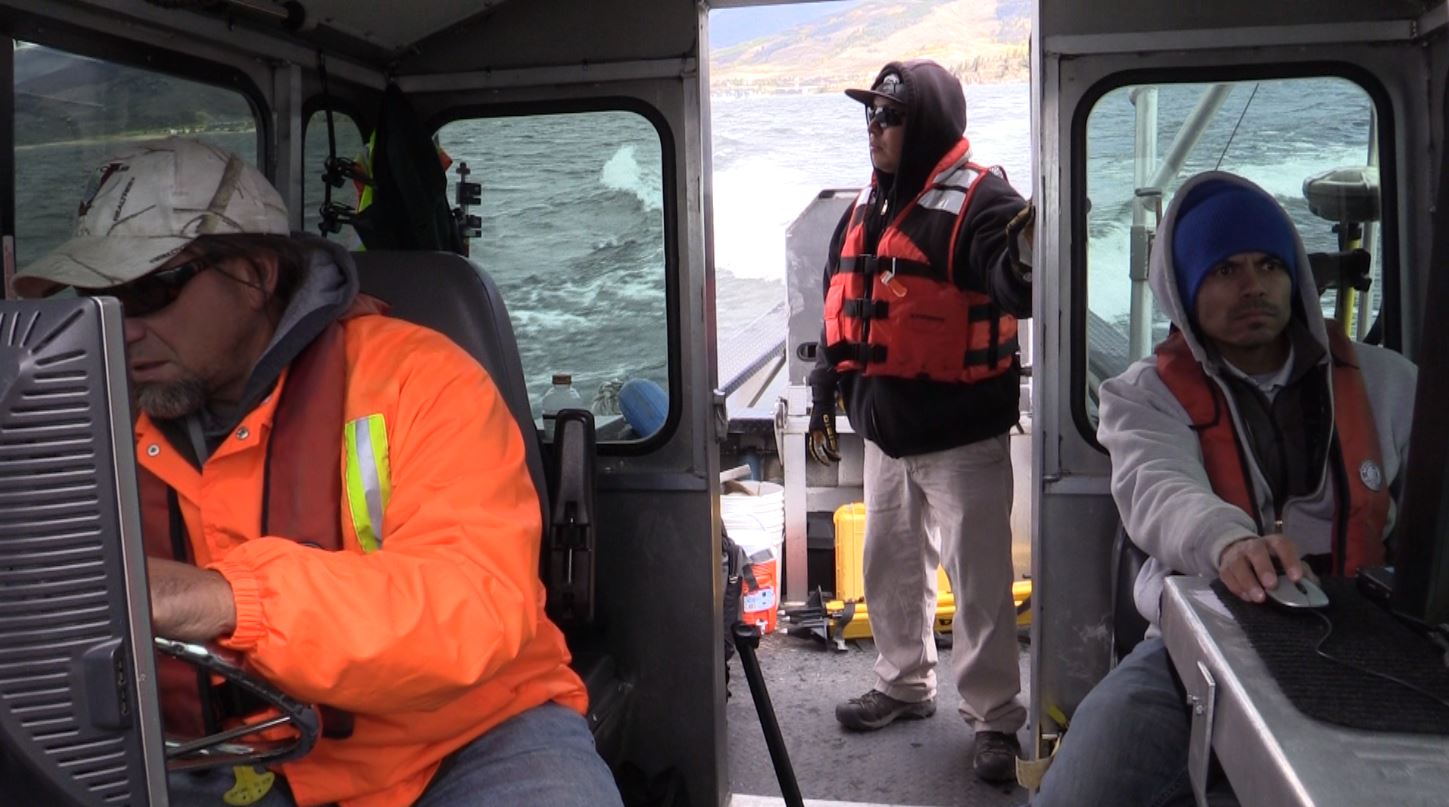
Like modern-day treasure hunters, they scour Dillon Reservoir looking for clues. Angelo Martinez, Jerry Kahl and Art Cardona are Denver Water surveyors on a quest to map the bottom of the reservoir.
“This hasn’t been mapped underwater since the reservoir was built back in 1963,” said Martinez. “Accurate maps are critical because they provide details of Dillon’s water storage capacity.”
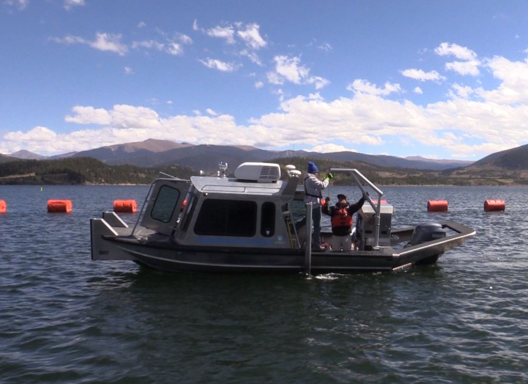
Martinez’s team uses a specially designed hydrographic survey boat — aptly named “Reservoir Dog” — to capture contour details of the reservoir bottom.
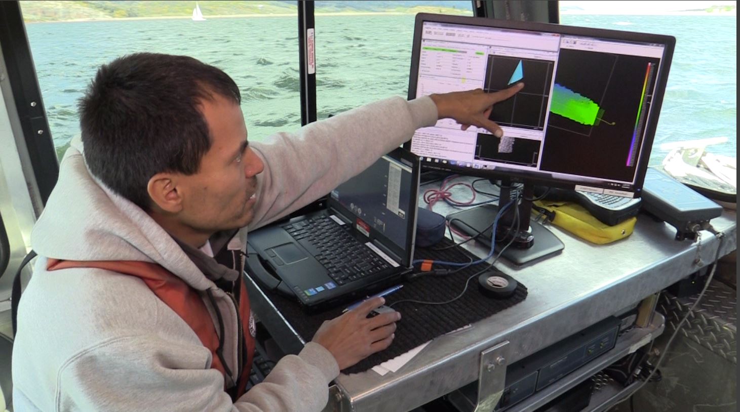
The survey team collects millions of data points that serve as clues to piece together a picture of what Dillon looks like under the surface. Denver Water uses the data to inform reservoir maintenance, dam safety and planning decisions.
Kahl navigates the waters, and Cardona sets sonar scanners in the water while Martinez plots the course and analyzes data from the onboard computers. “It’s a pretty high-tech boat,” Martinez said.
New technology allows surveyors to measure depths and create maps with much more granular detail, said Dan Thompson, Denver Water’s manager of survey. The old topographic maps of Dillon had 5-foot contour intervals, while the new maps capture 1-foot increments.
“Looking at our old maps is like watching the Broncos on a black-and-white TV,” Thompson said. “With our updated equipment, our maps have detail like a wide-screen HDTV.”
Bob Steger, Denver Water’s manager of raw water supply, said the survey data provides valuable information for his team, which oversees reservoir levels and releases. “As our customer base grows, it’s important to know precise reservoir capacities, because the yield our system can produce is dependent on how much water we can store,” Steger said.
Monitoring sediment flowing into the reservoir is another reason surveys are needed, he said. Sediment takes up space and reduces a reservoir’s storage capacity.
“Conditions change over the years,” Martinez said. “Our job is to map those changes and get a more accurate understanding of the terrain.”
The survey team uses two types of sonar beams to measure the reservoir, which is more than 200 feet deep in spots. Readings are coordinated with the boat’s GPS system to create a 3-D picture of what’s below the surface.
Martinez compares mapping the reservoir to mowing a lawn. “Back and forth, up and down. It’s a long process,” he said. The team mapped the reservoir’s 3,233 surface-acres over the past two summers, trolling by nearly 27 miles of shoreline.
The data and maps produced during the survey are a snapshot of the bottom of the reservoir that can be used for many years, Martinez said. “This is a good example to show how Denver Water really knows their system, cares about their system and cares about the future.”