Being in the know about the mountain snow
When it comes to supplying water to 1.5 million people, the spring runoff is the most important time of the year for Denver Water.
That’s why having good information about the snowpack is critical. Mountain snow is Denver Water’s primary source of water for its customers.
Watch as 9News Meteorologist Cory Reppenhagen talks to Denver Water climate expert Taylor Winchell about how climate change is affecting snowpack:
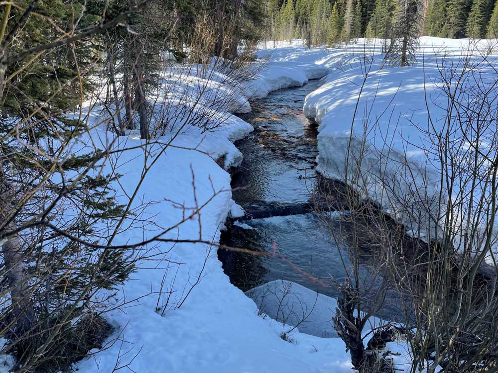
When the snow that piles up in the mountains over the winter starts to melt, the water flows into rivers and streams that fill storage reservoirs. The spring runoff typically starts at the end of April and wraps up in late June or early July.
But the work to count the snowflakes starts long before that.
“We keep track of the snowpack through measurements on the ground, from the sky and from automated sensors,” said Nathan Elder, water supply manager at Denver Water. “We monitor the snow all winter because it constitutes the majority of our water supply and has major impacts on how we operate.”
In 2023, the snowpack peaked below average in the areas where Denver Water catches the snowmelt. A below-average snowpack affects the amount of water available to capture and store in the spring.
"We would like to completely fill our reservoir system every runoff season," said Elder. "In the years when we don't hit that mark, it makes following the utility's annual summer watering rules even more critical for the Denver metro area."
Watering two days a week should be enough for most landscapes for most of the summer. (Only water a third day, if needed, during periods of extreme heat or dryness.)
Following the summer watering rules will help keep reservoir levels higher, in case next winter's snowpack is below average.
The snowpack data, reservoir forecasts and customer water use are some of the key factors used to determine if Denver Water might need to impose additional watering restrictions beyond the regular summer watering rules, which run from May 1 through Oct. 1.
Here’s a closer look at the primary ways Denver Water’s planning team keeps track of Colorado’s snowpack.
Spread the word, forward this story. Did you get this from a friend? Sign up here for Denver Water’s free, weekly TAP email.
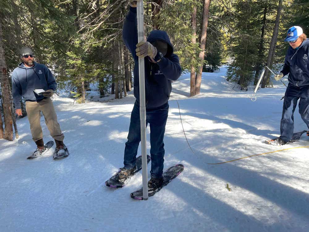
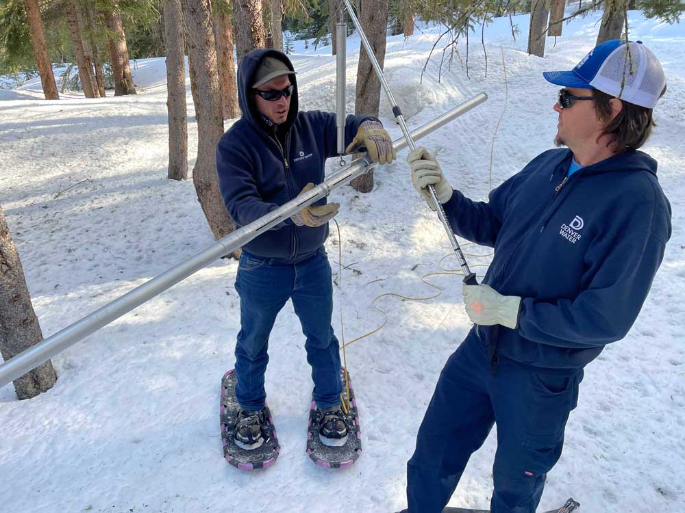
On the ground
Four times a year from January through April, Denver Water crews strap on boots and snowshoes and sometimes ride snowcats to trek into the forest to measure the snow in Grand, Park and Summit counties, the primary areas where the utility collects its water supply for customers in metro Denver.
Each journey follows a specific, predetermined route called a snow course.
Each snow course has 10 designated stops where workers jab a hollow tube into the snow to capture and weigh a sample of the snowpack.
At each stop, the crew conducts a four-step process:
- Collect a sample by dropping the pole into the snow until it hits the ground.
- Measure the depth of snow in the tube.
- Get the weight of the snow by weighing the snow-filled tube and subtracting the weight of the empty tube.
- Calculate the density of the snow using the depth and weight measurements.
Using these measurements, crews calculate the snow water equivalent, or SWE, to determine the water content.
For example, if 10 inches of snow has a density of 10%, the snow water equivalent — the amount of water left behind if those 10 inches of snow melted — is 1 inch of water.
Denver Water shares the data collected on each snow course with the National Resources Conservation Service, or NRCS. Denver Water is one of 15 agencies that sends people out to collect snow data at 95 locations across Colorado in partnership with the NRCS.
The information helps the agency develop water supply forecasts and monitor snowpack trends over time.
The NRCS’s forecasts are used by water provides, dam operators, farmers, ranchers, recreationists and communities to make important decisions about their water supply.
Silent sentries
Along with data collected by hand, Denver Water uses information from snow telemetry sites, or SNOTEL, sites during the winter.
SNOTELs, basically automated backcountry weather stations, were first installed in the 1970s and are operated by the NRCS. The federal agency currently has more than 900 SNOTEL sites collecting data in remote, high-elevation mountain watersheds across the western U.S.
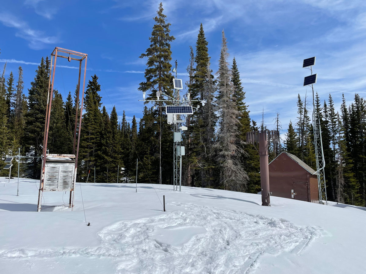
At each site, a bladder about the size of a queen-sized waterbed and filled with antifreeze monitors and reports the weight of the snow falling on it, providing information about the water content frozen in the snow. SNOTEL sites send data multiple times per day, although some sensors report hourly.
Denver Water uses information from 13 SNOTELs located in its 4,000 square miles of watershed.
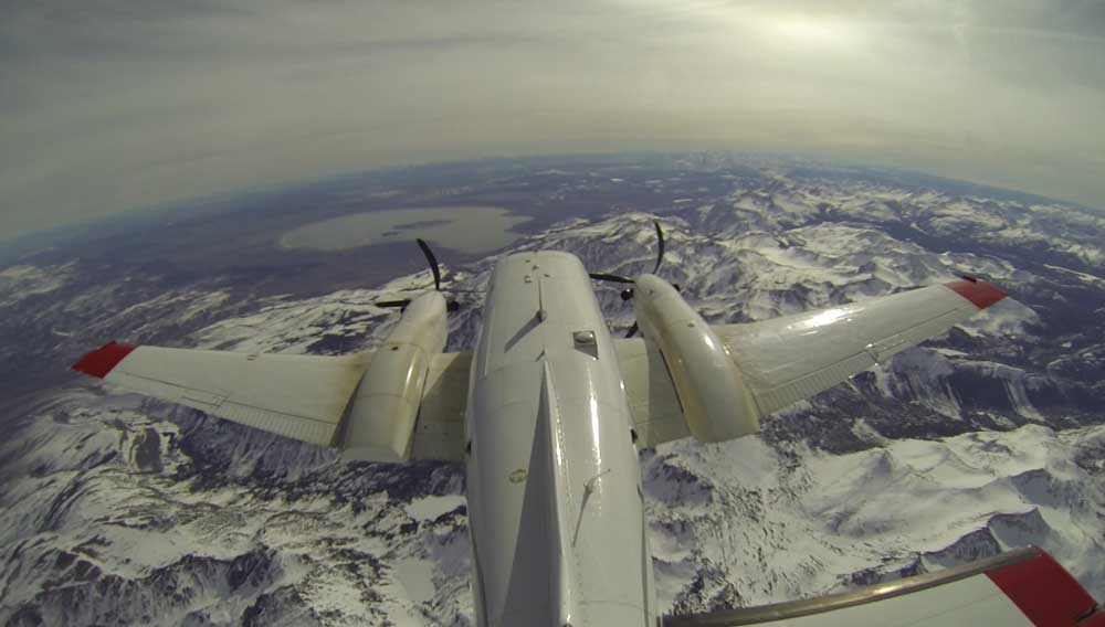
From the air
Starting in 2019, Denver Water began getting data about the snowpack from the air, using Airborne Snow Observatory planes stuffed with high-tech equipment flying over the snow-covered mountains.
The plane uses beams of light to measure the depth of the snow fields below and capture reflections from the frozen surface. The equipment pings the snow’s surface at up to 10 locations every square meter, and powerful computers crunch reams of data.
The flights provide an assessment of the amount of water frozen in place in the snow across hundreds of square miles that is more accurate than anything Denver Water has ever had before.
“The data we get from the Airborne Snow Observatory flights quantifies all of the snowpack in river basin below, rather than trying to build a picture of the snowpack in basin using just a few selected point measurements we get from the SNOTELs and the snow courses,” said Nathan Elder, Denver Water’s manager of water supply. “Imagine trying to watch a high-definition TV that only has 10 of its thousands of pixels working; you just don’t get the whole picture.”
And in the face of increasingly variable weather patterns related to climate change, having better information and more accurate forecasts of the seasonal runoff will be more important in the future, he said.
Putting it all together
Elder’s planning team uses data from the snow-measuring methods and combines it with other data such as soil conditions and weather forecasts to determine how much water the winter snowpack will send into Denver Water’s reservoirs.
“Having people hike into the forests to measure the snow by hand is very important for water planners because they give us the ‘boots-on-the-ground’ information we use to verify the data we get from the machines in the SNOTELs and the Airborne Snow Observatory flights,” Elder said.
The forecasts — in turn — help determine how Denver Water will manage the water stored in its reservoirs to meet customer demands in the city and determine if additional water restrictions are needed.
The water supply forecasts are also used to provide information to communities, businesses and other water managers about flooding concerns, water levels for boating on reservoirs, maximizing water rights and how to manage water supplies to benefit the environment.
“Managing water is a very complex business,” Elder said. “The more information and data we can get, the better decisions we can make.”