Image
News Article
Measuring the snow below, from 20,000 feet
New generation of high-tech snow measurements feeds Denver area’s water supply models.
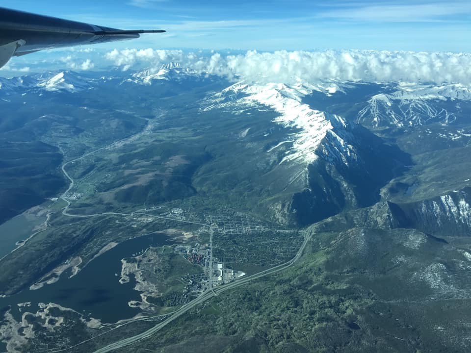
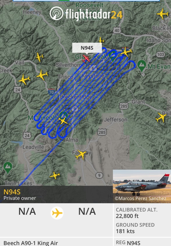
On April 18, a Beech A90-1 King Air stuffed with sophisticated equipment took off from Gunnison’s regional airport and soared over the mountains above Dillon Reservoir.
The flight occurred toward the end of the 2020-21 snow season, a nail-biter that has seen streaks of unusually warm, sunny days — and record-breaking heat in early April — broken by waves of storms and inches of snow that extended the ski season at some resorts.
In the air for three hours, the plane cruised above 20,000 feet, flying back and forth across the 335 square miles of high-country snow drifts that make up the Blue River Basin. Snow melting off high peaks and tumbling down the basin’s creeks ultimately ends up in Dillon Reservoir and the Blue River below Denver Water’s dam.
And as the Airborne Snow Observatories Inc. plane crisscrossed the sky, lidar equipment it carried shot beams of light at the snow below, capturing reflections from its frozen surface and measuring its depth. The company grew out of a seven-year research effort by NASA’s Jet Propulsion Laboratory.
Reams of data collected during the flight provide Denver Water with an assessment of the amount of water frozen in the snow.
Those calculations will in turn feed the utility’s forecast of the amount of water expected to flow into the largest reservoir in the utility’s system that 1.5 million people rely on for drinking water.
Image

“About 80% of Denver Water’s supply comes from snowpack and we want to be able to forecast spring runoff as accurately as possible,” said Nathan Elder, Denver Water’s manager of water supply.
“Getting more and better information improves accuracy and that helps us know if we have to go on watering restrictions, or what the impacts of runoff will be on the environment and recreation, how we should manage and move our water resources,” he said.
The mid-April flight was timed to be at or close to the peak of the season’s snowpack. It was the first of two flights Denver Water commissioned to collect data over the Blue River Basin this season.
Information from the first flight indicated there were normal amounts snow in the middle and lower elevations, but less than expected at higher elevations, Elder said.
“That’s important to know, because where the snow is on the mountain will dictate when it starts melting for the runoff,” Elder said.
A second flight in late May or early June will collect information about how much snow might be lingering at the highest elevations.
Image
That’s important because by then, snow at the four SNOTEL measurement sites in the basin, perched at about 11,000 feet, will have already melted away, leaving the utility and other snow watchers blind to water that might still be frozen in place at higher elevations — or may have already melted away.
“Based on the measurements and history we have, we can overpredict the amount of water in the snow or underpredict. Either way has consequences for how we operate our system, and is something we want to avoid,” Elder said.
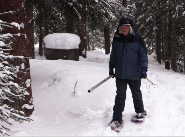
Historically, Denver Water and other water watchers gather information about snowpack and water supplies by looking at data from SNOTEL sites scattered across the mountains, including four in the Blue River Basin area, and information collected by crews snowshoeing to remote locations. Information collected during the season is compared to historical data.
But Elder compares the SNOTEL measurement spots to pixels in a TV screen.
“If you have four sites in the Blue River Basin, imagine watching TV and you have four pixels for the entire screen – you won’t be able to tell what’s going on. And if the pixels are in a line across the middle, like the SNOTEL sites are all between 10,500 and 11,400 feet, you can’t see anything above or below that line,” Elder said.
Throw in additional layers of uncertainty in shifting weather patterns due to climate change, and the confidence in data collected the same way it’s been done for decades starts to slide.
Image
“What we see now isn’t the same as what we’ve seen in the past. You can’t base today’s forecast on yesterday’s data, conditions are changing,” Elder said.
Gathering data on the snowpack by flying above it started in California and Colorado in 2013 and has occurred occasionally in various river basins across Colorado for several years, as utilities and others have had money available to commission flights.
Denver Water flew two flights above the Blue River Basin in 2019, then skipped 2020 amid the pandemic.
But several Colorado water utilities and entities are looking at the possibility of banding together to coordinate future flights, sharing costs and also sharing the data that comes from the flights.
“When Denver Water did the first Airborne Snow Observatory flights in 2019, we found incredible value from the information and we started to tell the story of those pilot flights at conferences,” said Taylor Winchell, a water resource engineer at Denver Water who works on climate change adaptation and water supply planning issues.
“There’s a lot of interest, but there also are a lot of questions about the cost, the information, timing – when do you fly – and where those flights might be the most useful,” Winchell said.
Information collected from the flights is another tool to be integrated into the wealth of information that exists about Colorado’s snowpack, and how it might change in coming years, he said.
Image

In April, the Colorado Water Conservation Board gave $45,000 to fund the Colorado Airborne Snow Observatory Expansion Plan, allowing the group to work through all the questions.
“This project isn’t designed to pay for the flights, but to create a plan for developing a sustainable operation in Colorado with consistent flights, across many watersheds, every year, with costs and information shared – similar to the California program,” Winchell said.
The planning team includes Denver Water, Northern Water, Dolores Water Conservancy District, Airborne Snow Observatories Inc. (a company that grew out of the NASA-led pilot flights in California) and Lynker, which specializes in water resources planning and analysis.
Winchell said the planning process is expected to get a diversity of water perspectives across Colorado, spanning state and federal agencies, agriculture and recreation interests, water providers, cities, researchers, environmental groups and Native American tribal groups.
“Airborne snow flights have benefits for everyone who is involved in water management,” Winchell said. “We’re trying to make sure all perspectives are included in developing this program.”
Image