Protecting a key reservoir while restoring the landscape
A small creek twisting and turning through a park in the foothills of Jefferson County is hosting a habitat restoration project with a dual mission.
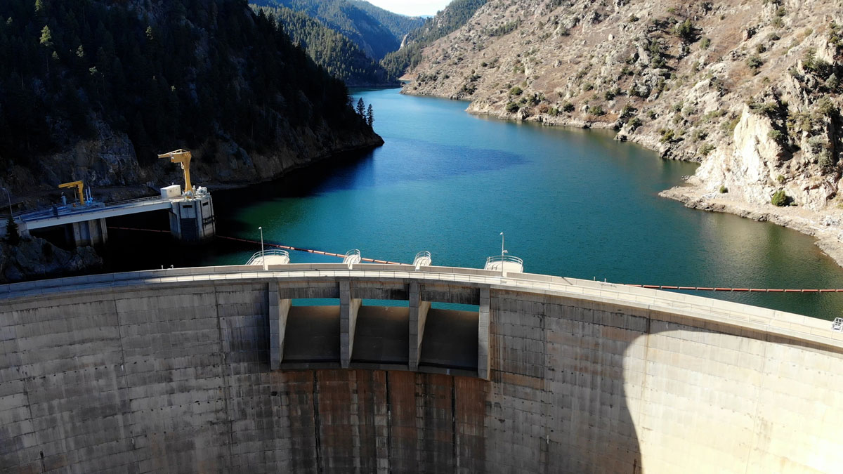
The Beaver Ranch Park near Conifer is managed by Jefferson County Open Space. The small stream is Casto Creek — a small tributary of the North Fork of the South Platte River. Both waterways drain into Denver Water’s Strontia Springs Reservoir at the top of Waterton Canyon.
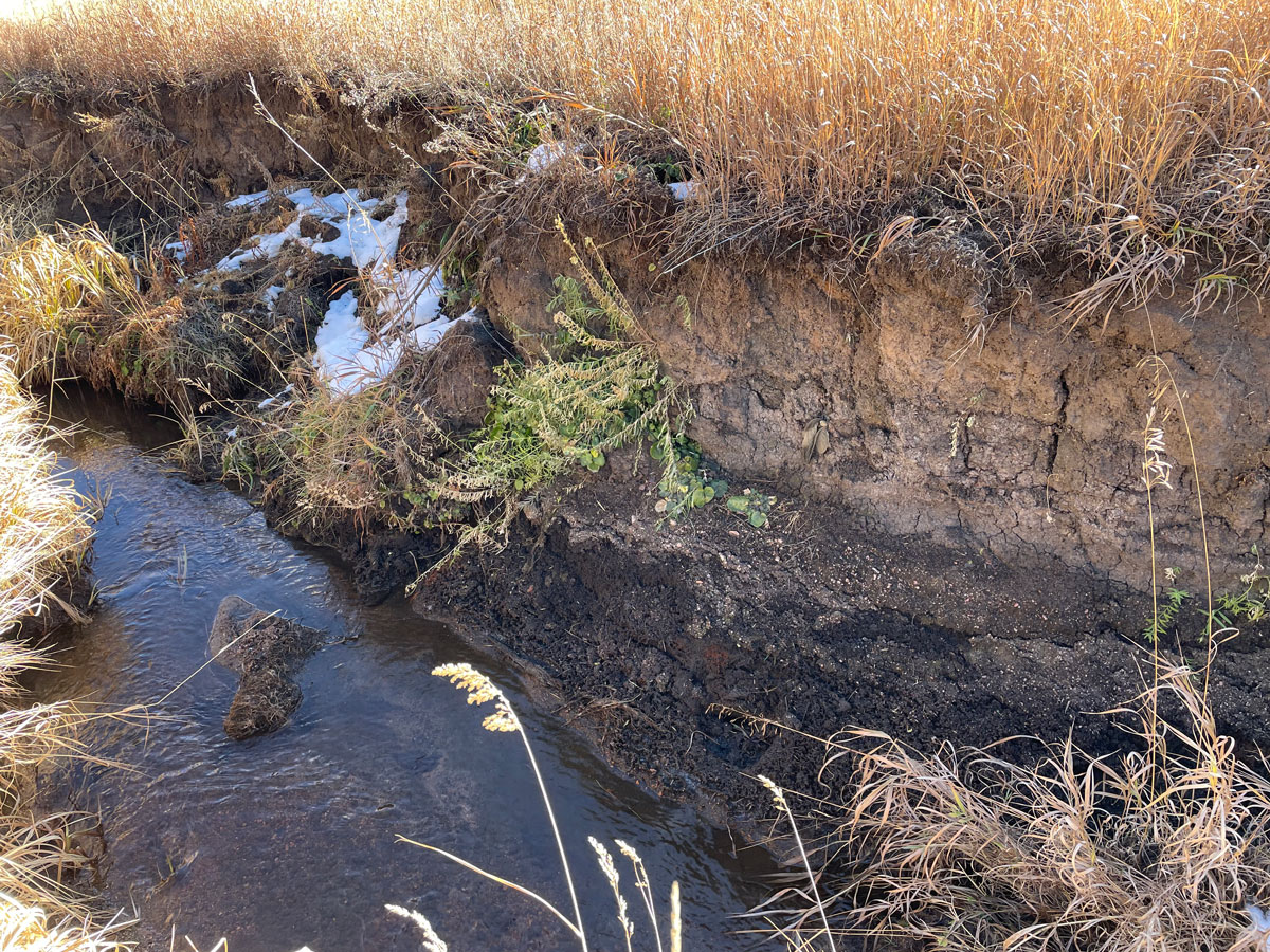
The area that is now the park once had more of a wetland environment that supported a variety of wildlife. But these days, the creek bed has fallen below the surface and is hidden by waving bunches of grass.
The desire to reduce erosion along the banks of the creek in the park brought Jefferson County Open Space and Denver Water together on a collaborative project. The two entities share a common interest — Denver Water wants to keep sediment from the creek out of a key reservoir and Jefferson County wants to keep the sediment in its park.
The project has two goals: Improving stream habitat through the park while reducing the amount of sediment that makes its way into Strontia Springs Reservoir.
Park problem
“Over the years, there’s been a lot of erosion along the banks of Casto Creek at Beaver Ranch Park,” said Kristina Duff, senior planner at Jefferson County Open Space. “There are some areas where the creek bed has cut through the ground and now flows about 6 feet below the surface.”
As the creek banks receded, the water table dropped so far down that the water is now below the root zone of the old wetland plants that once lined the stream.
A wide range of skills are needed to keep the water flowing. Learn more at denverwater.org/Careers.
“This area used to have more of a wetland habitat, but now it looks more like a grassland or agricultural location more common to drier regions,” Duff said. “The loss of this functioning wetland ecosystem has led to loss of habitat for wildlife in the area.”
Reservoir problem
For Denver Water, erosion of the tributary creek bed and banks adds sediment to the river downstream, sediment that eventually makes its way into Strontia Springs Reservoir.
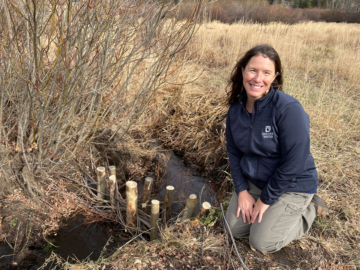
“Sediment consists of sand, dirt, rock and other particles,” said Alison Witheridge, an environmental scientist at Denver Water. “We estimate that about 50,000 cubic yards of sediment washes into Strontia Springs Reservoir every year.”
All that sediment can lead to problems for the valves, pipes and hydropower unit inside the Strontia Springs Dam.
Sediment also impacts the water treatment process because water stored in Strontia Springs Reservoir is sent to Denver Water and Aurora Water’s treatment facilities. Having to remove elevated levels of sediment can slow down the treatment process before the water is sent to homes and businesses.
Working together
Realizing that the erosion and sediment posed a problem for the two organizations, Denver Water reached out to Jefferson County Open Space to develop a mutually beneficial sediment mitigation project.
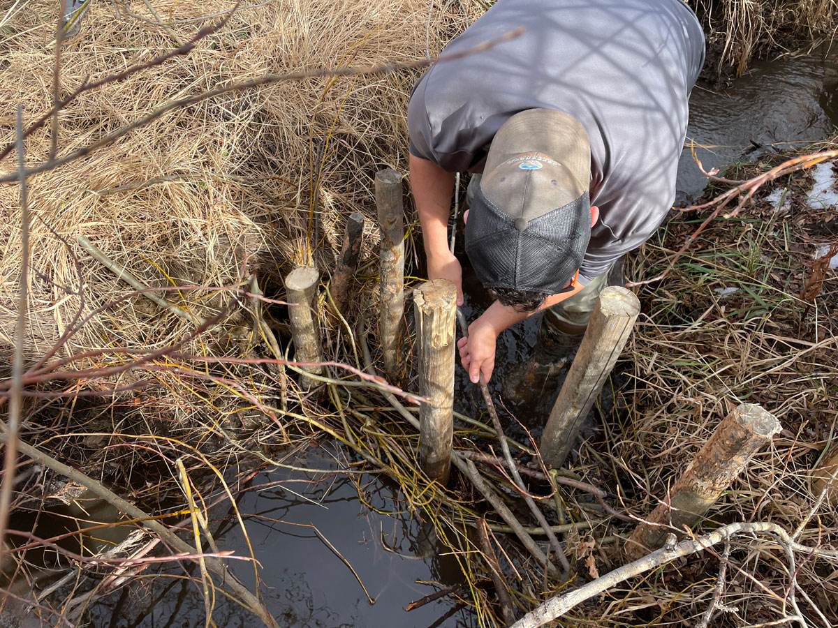
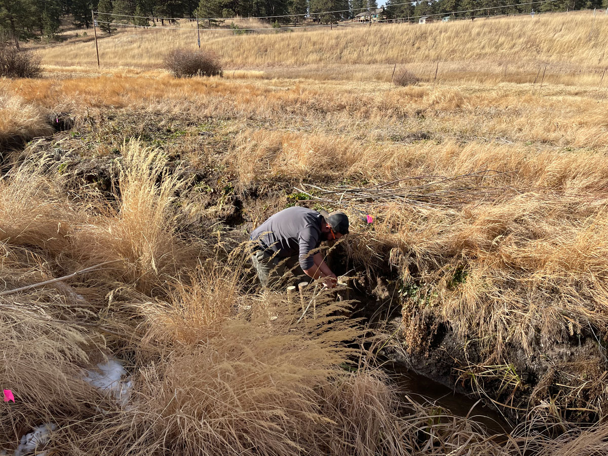
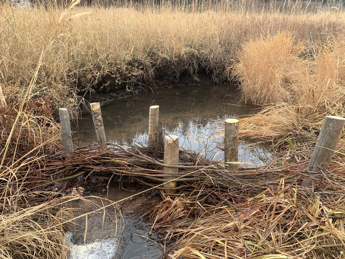
The solution involved adding a series of “post-assisted log structures” to a stretch of the creek about one-third of a mile long as it flows through Beaver Ranch Park.
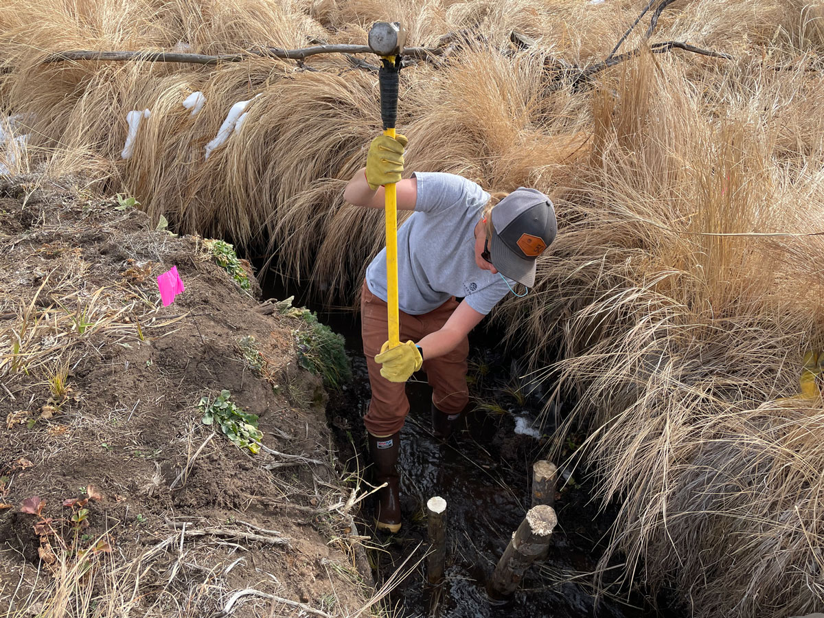
Working with Jacobs Engineering, biologists and other field staff members from Jefferson County Open Space installed the structures in November 2023.
“The structures are very simple and consist of wood posts that are pounded into the streambed with branches from willow bushes twisted around each post,” said Crystal Young, a watershed planning consultant from Jacobs. “The structures mimic what would normally fall into the creek.”
The small structures are about 18 inches high and allow water to pass through, but help sediment deposit behind them to settle onto the bottom of the creek bed instead of flowing downstream.
“Over time, the sediment will pile up and start to raise the height of the creek bed,” Young said.
This process sets off a chain of events.
As the creek bed rises, the water table in the ground rises. As the ground becomes more saturated, the eroded banks on the sides of the creek will fall into the creek and stop behind the structures, causing the stream bed to rise even higher on top of the sediment that’s been deposited behind the structures.
How much time it will take for the bottom of the stream to rise depends on the amount and force of rain as that impacts the amount of sediment that ends up in the creek.
Once the streambed reaches a certain height, a new series of structures will be installed to repeat the process until high water spills out over the plant communities, creating a more functional floodplain. At that point, the restoration process will transition into ongoing monitoring and maintenance to ensure future erosion is minimized along the banks.
“This is a way to basically use nature to solve a problem,” Duff said. “We hope to see this area return to more of a more functional wetland habitat in the future.”
Once restored, Duff hopes to see more wildlife return to the area such as deer, elk, amphibians and moose.
“We’re also hoping that restoring wetlands to this area will enhance the park experience for our visitors,” Duff said.
Pilot project
Adding the structures is a pilot project for Denver Water, Witheridge said, as the utility looks for ways to reduce the amount of sediment flowing into Strontia Springs Reservoir.
“We’re going to monitor this creek and try to quantify how much sediment has been kept from going downstream,” she said. “These structures are especially beneficial in times of flash flooding when we see the most sediment flowing downstream to our reservoir.”
A recent Denver Water study identified 81 potential mitigation projects as part of the utility’s Strontia Watershed Sediment Management Program.
“This is a long-term problem for us, so we’re happy to be working with Jefferson County Open Space on our first sediment mitigation project,” Witheridge said. “This is just one of the many projects we work on at Denver Water to protect and manage our watersheds.”