Image
One of the most daunting tasks in Denver Water’s landmark Lead Reduction Program was also one of its most fundamental: locating all the customer-owned lead service lines.
The water Denver Water delivers to customers is lead-free, but lead can get into drinking water as it passes through service lines and plumbing that contain lead.
And those service lines — the pipes that connect the house to the main in the street — belong to customers as part of their property. They were never installed or owned by Denver Water and no one had a complete record of which pipes were made of lead, copper, galvanized steel or plastic.
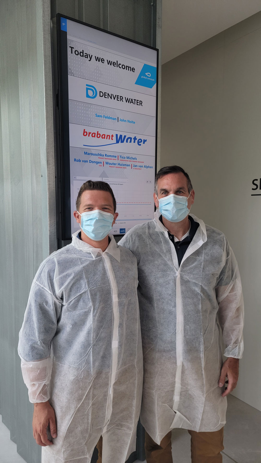
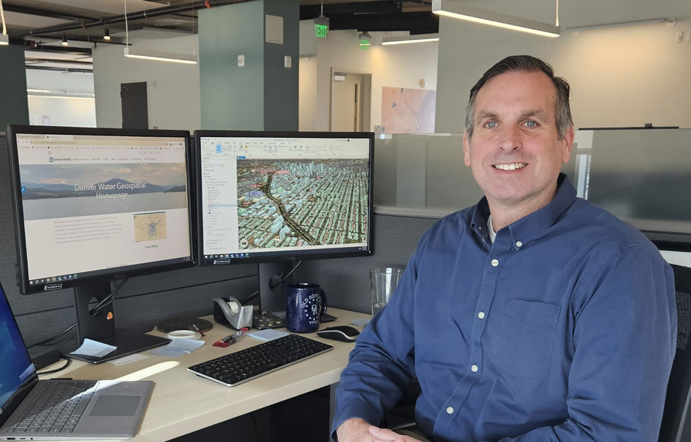
Inventorying the lead service lines in Denver Water’s customer service area, so the program could replace the lead lines with lead-free copper lines at no direct cost to the customer, fell to the utility’s geographic information system team, and to John Nolte, who helped oversee the effort.
They combed through old plumbing records, a former employee’s handwritten notes, city construction permits and details from Denver Water’s customer billing database.
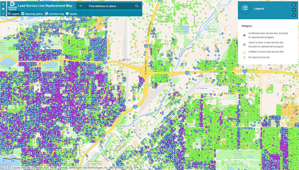
After months of research, the team narrowed down the list to a manageable, estimated range of 64,000 to 84,000 customer-owned water service lines in Denver Water’s service area that may have lead — a range that the utility continues to refine. The program also is providing customers enrolled in the program with water filters certified to remove lead, to use until six months after their line is replaced, and has raised the pH of the water to prevent lead from getting into the water.
From January 2020 through the end of September 2023, Denver Water's Lead Reduction Program has replaced more than 20,000 old, customer-owned lead service lines at no direct cost to the customer.
See what replacing more than 20,000 old, customer-owned lead looks like over time on this interactive map.
“That’s the beauty of GIS — you’re able to do that,” said Nolte, a GIS manager who has worked at Denver Water since 2018.
And that brings up the biggest misconception about GIS professionals, Nolte said with a laugh, “that we just make maps. I actually have several friends in GIS who are terrible with directions.”
GIS professionals design and develop systems, maps, dashboards and other databases to give complicated information a visual component.
Learn more about the different jobs needed to deliver clean, safe water to 1.5 million people every day, at denverwater.org/Careers.
“We don’t want to just see raw numbers; our brains don’t work that way,” Nolte said. “We want to see visualizations.”
Nolte has spent his 25-year career in the GIS field. As a college student in the 1990s, Nolte noticed a friend working on an old computer in the back of a hydrogeology classroom. The friend was studying a map of the Colorado River watershed at the time.
“I had no idea what it was for, but I fell in love with the application,” said Nolte, who was working on his environmental science degree at the time. “It was a bridge between field work and computer work, and the application made it really simple.”
That first look at GIS nudged him toward jobs with the Naval Weapons Station in South Carolina, the U.S. Environmental Protection Agency and now with Denver Water.
“You can really make a difference in the water industry,” he said. “Most people take it for granted when they turn on the tap that the water will be there. Water is going to be one of the biggest issues we face in the climate crisis.”
Nolte also was recently named a GIS Hero for the water industry by ESRI, a geographic information system software company. It brings international recognition for his work at Denver Water and highlights how he is using his GIS skills to make a difference.
“GIS is a power tool that can help us manage our water resources more effectively, sustainably and equitably,” Nolte said. “I am proud to be part of the water industry.”
Nolte also volunteers with the Urban and Regional Information Systems Association, or URISA, an international nonprofit that provides education and training, networking (including “mappy” hours), advocacy, and resources for GIS professionals throughout their careers. He’s volunteered both locally and nationally with URISA since 2014.
Nolte teaches at URISA’s leadership academy across the globe and has also helped coordinate their annual conference. Having previously served as treasurer for the local chapter, Nolte was recently voted president on the board of directors and is excited to take on the new challenge.
"I think URISA is embarking on an incredible journey as we grow and support geospatial professionals at all levels of their careers,” Nolte said. “It will be exciting to launch a new branding strategy, implement new ideas around diversity, equity and inclusion and develop new education programs."
Nolte has met dozens of close friends and mentored students new to the field, and he has learned about new technologies, techniques and equipment that can advance even the most puzzling projects Denver Water takes on.
“There are so many ways to manipulate data and make it visually appealing,” Nolte said. “These days, most of the people in this field are considered data scientists instead of mapmakers and geographers. But we all still have a love for maps and geography.”